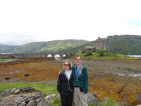
 Meredith and I grabbed breakfast back at the SoCoCo cafe again; it was cheaper than eating at the pub, and it was a good and scenic walk. Plus, I knew the day was going to be car-heavy, so I did not mind the extra walking. After breakfast, we walked back to the pub and checked out and headed westward, with our destination being the large Hebridean island of the Isle of Skye.
We got to drive along about twenty miles or so of Loch Ness. The loch is very pretty, but we did not see any monsters, and we must have avoided the most touristy towns, because we only saw one advertisement for a museum about the creature. The roads were fairly busy, though, so I can only assume the tourist trade is well.
During the drive westward, the landscape got more and more dramatic. There were more and more mountains, but these were different from the ones we saw in the center of Scotland. The western mountains were either green or rocky – there did not seem to be the patchwork pattern of heather we had seen earlier.
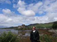 Close to Skye is a very pretty castle called Eilean Donan on a loch that is surrounded by hills. It is one of the most photographed castles in Scotland because of the landscape. The current castle itself only dates from the early twentieth century. It still seemed worth a stop. It seems we were not the only ones to think so, since approximately ninety-seven percent of Scotland’s tourists were there. There were four tour buses, and the three parking lots for cars were almost full – I felt lucky to find a spot, and this was at noon on a Monday. Yikes.
It was very pretty, and we wandered around the shore near the castle for about twenty minutes, with the strains of a bagpipe playing in the background (a bagpiper in full traditional kilt, but with a nose ring, which made us smile). It was a beautiful day, and it was good to get out of the car, but I decided against paying for access to the castle because of the crowds, and so we could get to Skye more quickly.
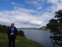 From the castle, it was a short drive over a very cool bridge out to Skye. Once on the island, my goal was to get lunch in Portree, the island’s biggest town (with about 2,500 people), which was still about forty-five minutes away – it is a big island. It seems as if the three percent of the tourist population not at the castle was chilling out in Portree. Again, parking was an issue, but we found a spot in a large lot right by the harbor. We had lunch in a nice cafe, and then we walked to the end of town, and up the town’s largest hill, where there is a park at the top. The views were spectacular, so we sat on a bench and ate the dessert we had brought with us. There seemed to be several small sailboats out near the harbor, so we watched them for about half an hour. We think it was a group learning to sail, as there was a small motorboat patrolling among the sailboats, and they all put in at roughly the same time at the same building in the harbor. Near to the park is a small tower that is open, and we climbed it, which gave us excellent views of the harbor, but I think the bench view in the park was the better place to see things.
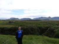 Our B and B was in Staffin, a small village north of Portree. Mer’s guidebook recommended a drive along the route we had to take, so we were happy to make several stops along the short drive. The landscape north of Portree is beautiful. You can usually see the sea, and there are mountains and lochs, and not many buildings – it feels very remote.
Our first stop was at the Old Man of Storr, a rock formation that is very dramatic. There is a huge column of rock that fell off a larger cliff and embedded itself in the ground. You can walk up to it, but the path is very steep, so going is slow and we had to be at our B and B about 5:00. My compromise was to go about halfway, to a ridge where we could clearly see the cliffs. The bonus was we also could see around us toward the sea, with rolling hills, a loch, and mainland mountains all visible. It was hard to know where to look.
The next stop was at the Lealt Gorge, which is a gorge carved out where a river empties into the sea. Since I am afraid of heights, I did not spend too much time on the path near the gorge, but we walked along the path to the end, and it was a pleasant place to stroll. The path ended above the sea, looking down on a small factory that had processed clay for industrial use until 1960. The only way to ship the product was by, um, ship, since there was not road. People hauled the chalky clay three miles overland to the factory to dry it. Again, I am grateful my heaviest lifting is typically my lunch.
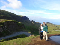 We checked in to our B and B in Staffin, and we love it. Meredith described our hostess as “our Scottish aunt,” and the view from our two windows is toward the sea and toward the nearby mountains. It is probably the most scenically placed B and B in which we have ever stayed. We grabbed supper in the village’s community center (one of only two places to eat in Staffin), and the food was excellent.
Based on both our guidebook and our hostess’ recommendation, we drove up the narrow road to the nearby Quiraing mountain pass. We had to negotiate several sheep in the roads, and we met two cars which required pulling off, but it was a pretty drive, and the views from the top were amazing. It was another place where it was hard to know where to look. We could have walked up more, but the path was on a cliff side, so I was leery of that. Plus, the winds were very strong and cold – I was in short sleeves in the village, but was up to three layers up on the mountain, and was still worried I would get cold. The wind comes a’ sweepin’ ‘cross the mountains.
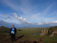 That ended the evening. We drove back to the B and B, where our hostess made me a hot chocolate and gave us muffins while we sat in the sitting room. We have another full day tomorrow to explore the island, and the weather looks to be good again.