 Skye set our new northerly position record – Skye sits at the same longitude as the southern Alaskan peninsula. We turned south today, heading to the Glencoe area, which also constituted our trip’s longest drive to accommodations, taking about four hours to get here. My brother Shannon had insisted we go to Glencoe, so we did. Of course, since I do these things on whims and last minute, the only hotel I could find was about $150 a night.
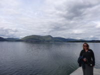
That turned out to be an okay thing, as we finally pulled in to the hotel in the afternoon, and it was sitting right on a seawater loch, Loch Linnhe, in the small town of Kentallen. Our room looks right out over the water to mountains all around. Not bad. In fact, after just an hour or so here, I booked us a second night, realizing that we would not fit in everything I wanted to see and do. Looks as if Shannon made a decent recommendation.
After lunch and our getting situated, it was about 4:00 when we finally got going on seeing the sites. That is late, of course, but Scotland is helpful with daylight until 10:00 or later, so we made good use of the time. We drove over to nearby Glencoe, which is dramatically surrounded by mountains. This greater area actually has Britain’s highest mountain, Ben Nevis, at 4,400 feet; there are plenty of hills around.
 We drove past the town to a parking area where there was a short hike I wanted to do, Signal Rock and An Tor. Mer’s guidebook had it marked as scenic, and it was right at the foot of the Three Sisters mountains, as well as another one. I figured Signal Rock would have great views, so I consulted the handy map in the parking lot, which showed three hikes, and set off on the black trail, which Meredith pointed out that her book said was strenuous. Phah! It led to Signal Rock! Up we go!
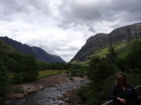
The trail started off well, crossing a bridge over a beautiful river that ran through a gorge with the mountains just beyond. It climbed up into a dense woodland area, and eventually the black trail split off from the lesser and unimportant blue and yellow trails. Of course, as befits the dignity and importance of the black trail, the trail went from a wide gravel trail to a deer path climbing steeply uphill, promising grand views. We did get them, actually – all along the trail we had the mountains looming over us, and it was not hard to take a breather after each steep section, pausing to look around.
Finally, after a fair amount of up, I saw a small side trail that led to a rock. This MUST be Signal Rock! I happily strode up to it! All eight feet of it. Densely surrounded by trees. Huh. Maybe this was just a false Signal Rock. The real one must be further along the trail. Off we go! We did come to an opening in the forest that gave almost full views of the Three Sisters, so that was a rest stop for us. The trail went down for awhile before climbing again, which was promising, before falling again, which was not. Eventually we rejoined the blue trail, and I saw a sign for Signal Rock, pointing back the way we’d come. The underwhelming rock must have been it, but at least the hike was great. We got back to the parking lot, and I looked at the map to see where we had gone. And there it was – Signal Rock. On the blue trail.
 Off we went again, across the bridge, up the hill, spurning the black trail and staying on the wonderful blue trail. This was easier going, and it also started going up. Great sign! We went on for about fifteen minutes, and started hearing German-speaking voices ahead. Great sign! Tourists! We walked up to an information placard and a huge rock – the placard explained this was indeed Signal Rock, and we could climb it using the stairs at the back! The Germans were already on the rock! Yes!
The rock was indeed huge, and the stone stairway was cool, and we made it to the top. To see six Germans and their dog, and lots and lots of trees. Surrounding Signal Rock. The Germans said hello and made their way down. After a minute or so of being swarmed by midges in the (first-time) breeze-free area, we followed them, and walked back to the parking lot. During this return walk, I noticed that for the first time of my being in Scotland, I was sweating. A first! The walk was still pretty, and at least we found Signal Rock.
We headed north to the tourist mecca of Fort William, the second-biggest town of the Highlands, with about ten thousand people. We happily found parking and made our way to the Crannog Pier, where there was a seafood restaurant and a place for boat tours. I wanted to catch the 7:30 evening tour, which is accurately not a sunset tour since the sunset is so late. But the evening sun is very pretty here, and it promised to give us great views of Ben Nevis, which towered over the back of the town. There was even a chance that we would see seals, otters, or porpoises.
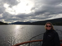
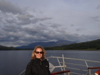
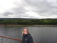 We got on board and headed out on a ninety-minute cruise. Having been sweating less than two hours before, I was now wearing four layers of shirts and jackets. That did the trick. The captain announced we were making a beeline for the right side of the loch further down. It turned out that the cruise offered a good view of the Jacobite Steam Train, which is sometimes known as the Hogwarts Express, having filled that role in the Harry Potter movies. Since Meredith teaches tons of Potter-crazed fans, this was an exciting prospect, if we could make it in time.
The scenery kept changing delightfully, with the loch all around, and different mountains coming into view, including Ben Nevis as we looked behind. We passed a campground on the right, and we waved at the family strolling the beach. We got past the campground to the train tracks, and we waited for a couple of minutes before we saw steam plumes in the distance. We had made it, and we got our picture of the Hogwarts Express.
The rest of the cruise was pleasant, with calm seas. We never did see any wildlife other than sea birds, but the surrounding views made up for that. As we returned to Fort William, Ben Nevis dominated the skyline, but some bare-rock peaks, shining in the evening sun, came into view as well. We also got to see a sea loch that marked the entrance to the Caledonian Canal that crosses central Scotland.
 We got off the boat and grabbed supper on the main shopping street before getting back to the car and heading back to Kentallen. Meredith got a delightful surprise – she teaches The Great Gatsby, and in the book, a major symbol is a green light at the end of a dock. From our room, there was a visible green light across the bay. It was on a buoy, but to Meredith it was Daisy’s dock and she was happy to have found it. In Scotland.
[The internet here is verrrryyyyy slow, so more pictures later.]
Ha! Shannon made a Blue Trail kind of recommendation! No Germans on the Signal Rock of that recommendation!
It was an okayish kind of recommendation. We are making due.