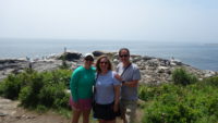
 Wednesday was forecast to be a beautiful, sunny day, if hot inland, so we decided to make that the day we would go to Acadia National Park, which is on Mount Desert Island, about three hours away from Livermore Falls. Brianna had indicated that it was the one place she would like to go in Maine, so away we went.
I had big plans for the day – get to Acadia and hike along the ocean, then go to Jordan Pond House for lunch and maybe hike around Jordan Pond, and finish up with driving up to and hiking to South Bubble Mountain, one of the mountains that overlooks Jordan Pond.
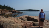 Right. We got to Acadia and parked about 10:00. We were near Thunder Hole, which is a tidal channel that booms when waves crash in. We checked it out, and it wasn’t booming much, but we sat on the rocks and looked at the ocean for a time, which became the go-to activity of the day. We found about half a dozen places we thought were good sit-and-watch spots over the course of the day.
We hiked south on the Ocean Trail, which is a fairly easy hiking trail along the ocean from Sandy Beach to Otter Point, a four-and-a-half-mile round trip. The sun was warm, but the ocean breeze was cooling, so we were comfortable. We took things very easy, stopping often to look around. We watched a few cliff climbers along the way, which looked terrifying, even with the ropes. We didn’t see too much wildlife (some seabirds), but the ocean crashing into the rocky shore was endlessly fascinating to watch.
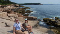 We got to Otter Point and turned around. The trip back was much faster, since we didn’t stop, and we got back to the Thunder Hole area around 1:30 or 2:00. We bought some water and ate some of Brianna’s planned-ahead granola bars, and plunged back onto the trail to finish it by going to the beach. That part of the walk was more crowded and less scenic, but still had some pretty places. The beach itself was busy without being over-crowded, and is a rare (for Maine) sandy beach. Meredith waded a bit, and we headed back.
By the time we got to the car, it was close to 3:00, and I began to realize that my original plan was overly ambitious. We drove to the Jordan Pond House, where we ate a light lunch of popovers while looking out at the pond. It was a pretty spot for a spot of lunch. By the time we finished eating, it was 4:00 and time to head home. Because of some delays and stopping for supper and then, afterwards, dessert at Fielder’s Choice, an ice cream stand in Winthrop, we finally got home after 9:00, for a fifteen-hour day. Whew.
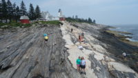
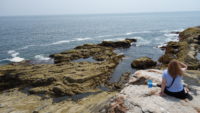
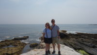 Today (Thursday), we started out late, as all three of us were puttering around (and I had to turn around to get my forgotten camera). As such, we didn’t get to Pemaquid Point until about noon. Pemaquid Point is home to a pretty lighthouse, but more importantly for us, it features some pretty incredible rock formations that slope down to the sea, where the waves hit the rock from many directions. If you like watching the sea, this is the place to do so. We ate some baked goods we had picked up near the Point, and then we spent about two hours moving from spot to spot, watching the sea. We could have stayed even longer, but Mer still wanted to visit her parents’ and grandparents’ graves in Rockland, see Rockland’s breakwater, and drive up to Mount Battie in Camden.
 We did stop at Moody’s Diner for lunch/supper about 3:00. Moody’s is a local institution, and so we were pleased to get Brianna there, where she was able to be introduced to Maine blueberries in the form of pie. For those who don’t know, Maine blueberries are much smaller than normal blueberries and are sweeter. They are raked off of ground-hugging bushes rather than picked. Brianna proclaimed she liked them.
We drove up to Rockland, to the cemetery. Mer’s grandparents’ gravestone was in great shape, but her parents’ stone was covered in a grey moss, so we cleaned that up.
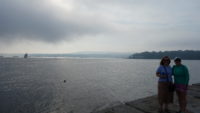 On to the breakwater; Rockland’s breakwater protects the harbor, and the breakwater is just shy of a mile long. We walked out to the base of the stones, which you can walk out on, when I remembered I needed my hat and sunglasses since the sun was shining (except for some light, wispy fog on the far side of the bay). I ran back to the car to get them, and ended up chatting with a retired couple who were sitting in their yard. The husband had taught in Livermore Falls until 1979, so we talked about people we knew.
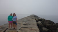 I headed over to the breakwater again, to find Mer and Brianna coming to find me. I had thought they had headed out on the walk, but they had waited for me. As we started the hike out, the fog started drifting in. The far shore disappeared, and then some of the boats, and then the bay. I knew we were in for real fog when both the lighthouse and the shore disappeared. It was an odd sensation to be visually stranded on the breakwater, but very cool as well.
We made it out to the lighthouse, which favored us by materializing out of the mist. We turned back and quickly lost the house in the fog again. We finally saw the shore when we were about ninety percent (or more) of the way back. We gave up on the idea of driving up the coastal Mount Battie, since we wouldn’t see anything, and so we started to drive home. We drove out of the fog in about five miles. The coast is a strange creature.
 So we had two excellent days on the coast. Saturday is starting to have a better forecast, so we may head back there to try Mount Battie again. Tomorrow’s weather forecast keeps vacillating, so we will probably have a low-key local day. After two long tourism days, we can use a bit of rest.