 Travel is a blessing in itself in that it exposes you to new experiences and ideas. But travel also has a way of reminding you what is important, like being thankful. Sometimes, travel reminds you to be thankful for a hot dog.
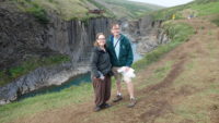
We started the day off in Lake Myvatn, and on check-out from our room, our hostess recommended we go see Studlagil Canyon, which was on our way east. She said it resulted from a dam being built, and the lower water exposed the canyon just a couple of years ago, so it wasn’t in most guidebooks. She showed us a picture, and it looked pretty amazing, and I like taking advice from locals, so I filed that away as a place to go should we have time.
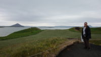 We first, however, drove a short way to the southern side of Lake Myvatn, to walk the Crater Trail. The trail weaves in and out of pseudocraters, which look like mini-volcanoes; they are the result of when lava hits water – the steam explosively escapes, and the magma builds up on itself. It was a cool but dry morning, and a farmer was out in his tractor aerating his hay while a small herd of horses grazed on a hill overlooking the lake, with a large volcanic crater in the background. It was a great place for a hike.
We took in all the cones; the crater trail only takes twenty minutes. We took an easy stroll down a longer path that went by the lake and caters to bird watchers. That path also still wound around some small craters, and it took about forty minutes to hike. That also got us to about 11:00, which was when a cafe we wanted to go to opened.
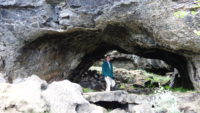 The cafe was at the trailheads of the Dimmuborgir lava fields. “Dimmuborgir” means “dark castles,” and these dark castles are huge columns of various lava formations. Local lore says they are trolls that turned to stone in the sunlight, and Meredith and I saw one that was pretty clearly troll-like on our walk. We got launched into the labyrinth after we had a hearty breakfast/lunch of all-you-can-eat soup and bread.
There are various trails, many of which are paved, in the Dimmuborgir area, and we studied a map of the system. I saw a dashed line that went right through the heart of the columns, so we took a paved trail to that trailhead. Which was marked, “Warning! Difficult trail!” I was pleased.
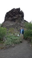
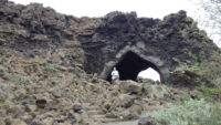
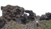 The trail wound all through arches and columns and caves and craters. We even saw some cracks in the ground that still had ice in them. The trail was tough, and went up and down and around craters and stones, but it was magnificent to be surrounded by such rough beauty. When we came out on the other side to a standard trail, I saw a sign for “Kirkja,” so I had to check it out. It was about a third of a mile away, and turned out to be a huge stone arch that looked a little like a vaulted church, thus presumably leading to its being called “Kirkja,” the Icelandic word for “church.” Good side trip. We headed back on an easy trail to the parking lot and headed out eastward on Route 1.
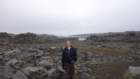
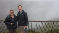 I decided that since Route 1 took us within twenty minutes of Iceland’s largest waterfall (by volume), Dettifoss, we should swing by. As we got close to the turnoff, it started to rain a light rain. We pressed on, figuring it might let up. We got to the parking lot, and it was still raining, so we broke out the Westfjords clothing and walked the mile to the falls. The last half of the trail was through basalt rocky areas, which were fascinating. So was Dettifoss – you can see the spray from the falls from the parking lot, which is about a half mile away in a straight line. The torrent of water was impressive. As always, I couldn’t get too close to the canyon edge to look down, but the roar was very loud, and the spray from the falls easily came back up over the canyon walls just north of us (on our side of the canyon, near a viewing platform). We walked around to get different angles on the falls, before we carefully walked up to the viewing platform. That was better – I could safely see down into some of the canyon. As we left, once we got away from the falls, we discovered it had more or less stopped raining – the mist we were getting hit with was all from the falls.
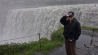 Because I was now wet and cold and had to use a bathroom, we skipped going south to the nearby (half a mile away) Selfoss falls, but we were very pleased that we could still see them from the trail as we walked back. We had missed them on the way out because we were facing the wrong direction. Iceland 360!
We got on the road just before 4:00, headed east again. This turned out to be the only fairly boring drive in Iceland that I have done. The road passed through uninhabited stone and rock fields, but rarely with anything interesting going on. After what seemed to be a long time, we saw the sign on the side of the road for Studlagil, the canyon our hostess had told us about. We turned down the road about 5:15, and I figured it would take us a half hour to get there (the Google map she had shown me did not seem to show it too far away), half an hour there, and half an hour out, which would have us to our guesthouse by 7:30. Late, but not too bad.
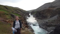 Then the road turned to gravel. Bad gravel – it was wash-boarded in many places, which shook the car quite a bit and slowed us down. We plowed on. We saw a signposted map and discovered that the canyon was sixteen km away (ten miles). No big deal. After a bit, I did the math and realized that this would take us thirty minutes at safe speeds, and we had already been driving a bit. We pressed on. We pulled off the dirt road into a small parking lot only to realize most trucks and jeeps were still going. We saw cars gleaming in the sun a couple of miles down the road, so we went across a bridge and onto this new road.
 I should say “road.” It was really a tractor trail. And a one-lane one at that. But I felt that since we had so much time invested, we should push on, and the road was only a couple of miles long. We safely reached a full parking lot, so I parked on the side of the road, safely out of the way. We had made it! It had taken much longer than I’d thought it would, but we would walk to see the canyon and then be on our way.
We started walking, encouraged by the steady flow of people coming back in the other direction. We knew that we were on the right path and that many people thought it was worth seeing. The footing was rough – coarse gavel, newly put down, so it felt like walking in coarse sand, which is hard. We trudged on for some time, and I finally asked a man how much further. He told me about thirty minutes, but that it was a good viewing point. By now, I definitely had too much time invested to turn around, so we went on. And on. And on. Turns out, from where we parked to the canyon was two miles.
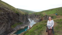 And just as you start to see the canyon, you can also see the observation deck on the other side of the canyon. The one with the metal stairs. The metal stairs that lead to the road. The dirt road I had been on an hour, and two miles of hard hiking, before. I was a little put out by that revelation.
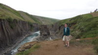
The good news is that the canyon is beautiful, and our non-road side was the better one for viewing. The observation deck side was taller than ours, so we could see more of the basalt columns that were on that side of the canyon. Additionally, we could wander around on our side all over, finding different viewpoints. Some people even climbed down to the river level, and we saw at least two people jump in for a (quick) swim. We hung out there for some time, and hiked out.
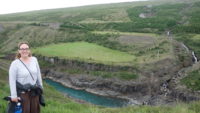 By the time we got back to the car, it was 7:30. And we still had to drive out and get to town. Many things in Iceland close at 8:00, and almost everything closes by 9:00. We began to brace ourselves that we might be going hungry tonight.
We got near to town. I had no specific idea where our guesthouse was, and I wasn’t sure if we would find anything open to go in and ask. So I prayed that we would find it, and as soon as I stopped praying, Meredith saw a sign for it on the side of the road. Thank you, Lord. Travel can teach thankfulness. We skipped the room and drove straight into town to see if we could catch something open for food.
 We saw a Subway with people inside. It was 9:07, and we went in, only to be told they were closed. We saw a nearby N1 gas station with attached store, so we went there figuring we could at least pick up some snack food. It was mobbed with cars, and had a restaurant attached. We were going to get supper after all! We were looking at the menu when a man told us the kitchen closed at 9:00. Sigh. We figured we could still get snack food, when we saw some pizza in a glass case, for selling by the slice.
We got in line. We were going to get pizza! We were fourth in line. The woman at the front had a bunch of stuff, and then at the end pointed at a bunch of different pieces of the pizza. All but four pieces gone. That was still okay. The next woman asked for two pieces. Two left. That was okay – we saw two hot dogs left as well, so we could get pizza and hot dogs. Then a man who wasn’t in line asked the clerk behind the counter for a hot dog. This was getting rough.
 We got to the front of the line and asked for the pizza and if we could have two hot dogs. I asked just out of desperation. Turns out they have a bin of warm water hot dogs in waiting (Icelanders love hot dogs, so I have been told). So we had two pieces of pizza and two hot dogs.
We ate with real gratitude. We hadn’t eaten since noon, and it was now about 9:30. We had walked fourteen miles (according to my watch), and driven for couple of hours on good roads and over an hour on rough roads. We were tired and hungry, and we were thankful for gas station pizza and hot dogs. And we still are.
 Travel makes you keenly aware of your need for kind people and for God’s provision. That is one of many reasons we keep doing it.