 Rites of passage are important. You often remember them your whole life long. Today was one such day – we got our first British Ordnance Survey map. My brother, who owns approximately the entire island of Great Britain in survey maps, will be proud.
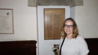
But first we left Salisbury, but not far. We drove a couple of miles on narrow lanes to a tiny church – the Church of St. Andrews. It was a cute building, but I wasn’t sure why we were there. I found out inside when we saw the list of rectors of the church – the 1630 entry was George Herbert, whom Meredith’s dad loved for his religious poetry. Mer and her parents had been in the church about forty years ago, so she wanted to pay tribute to them by going back.
 From there we drove about two hours to the Dartmoor National Park. Dartmoor is an area of rolling hills with few trees (too much wind), and many of the hills are covered in bare towers of rock called “tors.” Sheep, cows, and horses wander freely, often in the one-lane roads – it seems as if Dartmoor took the Iceland/Ireland road challenges of the last two years and threw bovines in the mix. One or two of the roads actually were so narrow my tiny car was brushing the vegetation in the hedge – on both sides of the road at the same time. We managed.
 We started the Dartmoor day in the town of Chagford. It’s just a tiny village, but has a beautiful church from the 1200s and a sprawling churchyard that’s being allowed to grow wild to support butterflies. We checked out the church, and then went into a very old-school, multilevel, floor-creaking hardware store, where we bought a North Dartmoor map. But, lest Shannon tear up with pride, we actually got the OS Landranger map, which is an Ordnance map but at a 1:50,000 scale instead of a 1:25,000 scale. We couldn’t see every rock in the moor, but it was still very detailed.
 We asked at the hardware store to direct us to the deli for which we had been looking as a place to get lunch. It turned out to be one of the buildings backing up to the church. If we had gone out a different church gate, we would have been at the deli. We got lunch and ate it at a table for two at the back, inside the churchyard. I’ve never eaten in a cemetery before, but it was a pretty (and quiet) place to have lunch.
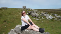
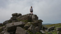 After lunch, we did most of a circular drive that is recommended in Meredith’s Rick Steves guidebook. We went south and in a counterclockwise direction. Our first stop was a short side trip, to Hookney Tor and the Bronze Age “fortress” of Grimspound. Grimspound is a circle of stones with hut foundations inside the ring. The outer wall may have been for keeping the animals in, but either way, it is still impressive to see clearly the village of people from four thousand years ago. Above the stones was our first close-up encounter with a tor, which was worth the climb. Meredith forgot her long, flowing dress, so we couldn’t fully recreate the Keira Knightley Pride and Prejudice film sequence of her standing on a stone outcropping while the wind blew her dress back. But we tried. Mer dutifully scrambled up onto the tor, and I took the picture. We then hung out there for about ten minutes or so before heading back to the tour.
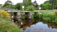 We stopped at the crossroads of Postbridge to see a clapper bridge – a stone slab laid on stone columns to bridge the river. The bridge dates from 1200 or earlier and can still be crossed. The stream it fords is clear and clean and pretty, so I dipped my toes in it.
We drove through the town of Widecombe-in-the-Moor, and tried to find the road to Hound Tor, but we missed it. Rick had misprinted the name of the town for which we were looking (it should have been Manaton, not Menton), and if there once was a sign to the town, it is long gone now. We ended up driving all the way into Bovey Tracey, which is where our rooms are for the night. So we went ahead and got checked in and had supper at the inn’s restaurant.
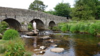 Fortified, we went back out on the road to find Hound Tor. We had a landmark from the hostess (a hill leading into a town), so we felt confident. We again looked for the sign and overshot the road since there is no sign. We turned around and went back, sure we had the right road. If only we had had a map with us!
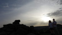
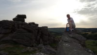
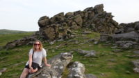
Anyway, we did find Hound Tor, which is huge. It’s big enough that we saw a couple of rock climbers practicing on the largest face (probably about fifty feet high). We found our own outcropping of rock, took some pictures, and then sat there listening to the distant calls of sheep and cows. In the lowering sun on a beautiful night, it was pretty perfect.
 We headed back to town to the inn. We already knew the way. Tomorrow, we move on to Cornwall, but the very brief introduction to Dartmoor was a day well spent.
George Herbert! Pride & Prejudice!!
Reeeeeecckkk!!! Sounds like a wonderful day.
Mer was in charge. Of course it was a good day. 🙂
Shoot – if we’d been thinking, I could have sent you some maps.
We went for a walk on the Dartmoor one fine March day and the freezing fog (literally was slowly coating things in ice) was so thick we had a hard time finding some of the formations you visited even when we were just a couple hundred feet a way. 4 of us had iPhones with compasses and we still couldn’t find the house we were staying at: turns out we were only a few hundred yards from it.
Good times.
How did you find the house? One in each direction within yelling distance?
You have the best vacations.
We wandered through deep cow manure until we hit a road. Once on the road, we could find our way back to the house.