It was still my day, we were still in the Bohemian Paradise, and so today was about more rocks. But, this time, it was with much less elevation. I made up for that with more distance today. Our hotel clerk recommended the hike today between two castles about two and a half miles apart. The trail followed a mostly dirt road along the spine of a hilltop, so there were only a couple of hills along the way. No stairs. All good.
It was a great recommendation. We got to the southern castle (think more of a chateau here and less of a repel-the-peasant-hordes kind) and paid to park. When I was asked how long we would be there, I made a wild guess and said four hours. We paid our ninety crowns (about four dollars) and parked. I decided we should pay the two extra dollars to get a ticket to see the exterior of the castle, which I figured would have great views.
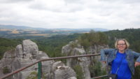 Both the southern castle and the northern one were built on the stone columns we had come to see. It does give you a commanding start to your castle height, so why not? It also affords great views. Hruba Skala’s courtyard mostly looked out on countryside, but if you looked south you could see Trosky Castle, and if you looked north you could see rock columns sticking up over the tops of surrounding trees. The trees are really tall here.
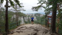
After exploring the castle, we headed north along the path/road. It went through fairly dense forest, but with rocks sticking up in many places. Because of my four-hour time limit, I decided to ignore some side trails and some stops we passed, and we focused on staying on the trail to the second castle, Valdstejn. About a third of the way there, we got to our first overlook, for which Mer now knows the word. We walked out onto a point, and we were greeted with an amazing sight – huge rock towers sitting in the midst of a forest. It was very impressive, with dozens of columns sticking up, some in groups and some alone. We could not yet see Valdstejn Castle, since (as it turned out) the rocks were in the way. We lingered there some time.
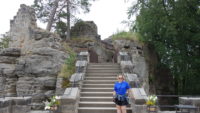 We jumped back on the main trail, but quickly found a bench that overlooked the rocks, so sitting there claimed more of our time. On the heels of that was another lookout, this time right up close to some of the tallest rock examples. Time kept ticking away.
We made it to the other castle, but then I had to see inside the walls of that one too. This was a later-modified castle, and had several buildings and levels, and so it took some time to get out to the platform the last private owner had built in the 1800s. I can see why. It looked south over the forest of stone, and in the distance, clear against the sky were the two towers of Trosky Castle. More time, but well spent.
We had a little over an hour to get back to the car, two and a half miles away. So we skipped the interesting but illegible-to-us poster advertising something dragon/bat/lizard-ish going on in the back moat area, and we headed south. I did decide we had time to stop and look at the north-facing overlook again; it was too beautiful to pass up.
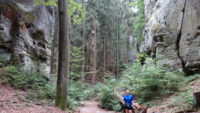 We were making good time, so when we got really close to the car and I saw some stone stairs going down into a crack in the rock, then surely we could take a look. That led to a sort of chamber of stone (with no roof, of course) with another stairway. We had time. That led down into a cathedral-like space of towering trees and rocks, with a path that wandered away. We took it about a hundred yards until I knew we were pushing our luck. I told Mer I wanted to go buy two more hours of parking so we could come back. She told me to go ahead since she knew I could go faster.
I hustled back, afraid of being fined or towed. I found the three parking attendants and asked if I could buy two more hours. A woman spoke decent English, but looked confused. I told her I wanted more time for parking. She asked me how much I paid. I didn’t remember, but I told her it was for four hours. She told me that I had paid ninety crowns, and that meant I was good for all day. Ah. I see.
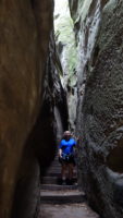 The good news is Mer laughed when I met back up with her, and we had more time to go explore the new trail we had found. We went back down to the cathedral-like clearing and followed the trail. It wound around giant columns interspersed with tall pines and other trees. We kept being amazed that fantasy films had not been made here – it certainly would have done for Middle Earth. We got to the end of the path, where we could see it joined up with a road, and so we went back to a stone stairway we had skipped, this one going up. The stairway was narrow, especially compared to the height of the stone on either side. We finally came up between two picnic tables, back at Hruba Skala.
We checked out the courtyard one more time, and then drove off toward the town of Semily, about thirty minutes northwest. The interesting thing about driving by GPS is that it seems the GPS is largely concerned with getting you there in as direct a line as possible, sometimes bypassing better roads to shave off two minutes. As such, we found ourselves driving up, over, and down a small mountain with a winding road, and two (presumably local) drivers who seemed determined to mate with my back bumper. I finally found a pull-off to let them pass, and then the GPS told me to turn right.
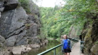 This road was a good example of a classic back-country Irish road. No shoulder, and just a little over a car-width wide. We laughed at it, and the the tar road started showing signs of wear. The grass started popping up in a few places in the middle. And it got narrower. And then there was a lot of grass between two strips of tar. Until there wasn’t. Then it was a gravel car path. With bad sight lines. Mer asked me where I was taking her, and I told her it was supposed to be a good-sized town. Just as I said that, we rounded a corner and she saw the town laid out less than a mile away. Somehow this cowpath of a road led right into a residential neighborhood. I have only been on one road that primitive before (in France in 2007), and this one may have had the French one beat. It was only by God’s grace that I did not meet another car coming the other way (or even a hiker, for that matter) – there was no room, with very few places to pull off.
After a quick stop at the TI (tourist bureau), we found our way to the reason we were in the town, which was to hike the Rieger Trail (Riegrova Stezka). I had seen a picture of a boardwalk attached to a cliff face over a pretty river, and I wanted to see that. Besides, the river hike would be flat for our tired legs. And it was – no individual part of the switchbacks were particularly steep. Sigh.
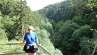 The boardwalk was right near the start of the trail and was pretty, and it had the added bonus of being across the narrow river from a rock-climbing course, so we saw a couple of climbers coming down the rock face. Our trail turned into the woods and started going gently uphill. Until the aforementioned switchbacks, which put on some serious elevation in a hurry. We huffed our way over that, and went on to a viewpoint, where a bench looked out at the river in an area of gentle rapids. We sat there and enjoyed the water and the sun for some time, and then I figured we had to head back home, since it was already after 5:00.
Happily, the GPS left the cows alone, and we had good roads all the way back to the hotel.
When you’ve “done” Europe, if you’re not too old to be mobile, you should try out some of our national parks. Since you like rocks, Bryce Canyon in Utah would be great for you to see/hike. It is indescribably beautiful and unusual.
So I have heard from multiple sources. Too many cool places on the planet!