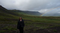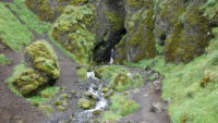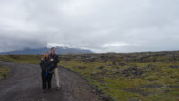
Author Archives: mriordan

Iceland 2021, Day 11 (Wednesday), Egilsstadir to Southern Coast

Meredith has a travel axiom – you will waste some time or some money when you travel, and it is best not to fret too much over it. Due to a map error in our guidebook that mistakenly placed our cabin near a sight I wanted to see, I ended up wasting an hour of driving today on top of a long driving day already. These things happen, and it was still a good day.

Today was not a “the journey is the destination” day. I wanted to get us to Iceland’s south coast region as quickly as I could. It was still amazingly scenic – we drove in and out of at least half a dozen fjords, and there were many places begging for a photo stop. I pressed on, with only two bathroom stops over six hours. But we made it in time.
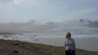
I had been aiming for the Fjallsarlon glacier lagoon. It is the smaller of two lagoons in the area, formed by the retreating Vatnajokull glacier. Being the smaller lagoon, it is far less crowded than the bigger and better-known (and tour bus stop) Jokulsarlon lagoon. Moreover, the Fjallsarlon location had boat tours on a more intimate scale (since the lagoon is smaller), getting you up close to the icebergs in the lagoon as well as to the glacier face. We got there a little before 3:00 and got booked on a 3:30 boat. We wandered up to a viewpoint over the water to fill up the time, and then headed back to get suited up.

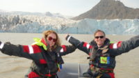
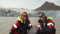
For safety reasons, you have to wear a jacket that keeps you warm should you fall in the water, and over that is a lifejacket that inflates on contact with water. Since the tour takes place in an inflatable craft where you sit on the rim of the boat,  these are good precautions. (We didn’t fall in.)
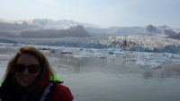
There were eleven of us on the boat – eight adults and three older children, and then the pilot. He was both informative and amusing. He passed on that the boat was as unsinkable as the Titanic, and we would be fully safe as long as we saw no icebergs. He also told us there are three main colors of icebergs – blue, for ones newly calved from the glacier; white for any iceberg older than a day old; and dirty ones that scraped the mountains along the way down. Blue icebergs are blue because they are dense from being compressed during the five-hundred-year journey to the lagoon. When those start to melt (within a day), air gets absorbed into the surface ice, which makes them look white.

The trip was thrilling to me – not like anything I had ever done before. To my recollection, I have never been in an inflatable boat, let alone one surrounded by icebergs. We started out and headed toward where the ice had drifted back toward the glacier (the wind was blowing that way for much of the day). I was disappointed that the ice formed a solid mass and there did not seem to be a way through. Our pilot told us to hold on and rammed up on a small iceberg, which was especially exciting to me and Meredith, since we were sitting in the prow of the boat. With the nose of the craft beached on the iceberg, the guide simply used the boat to move it out of the way, since the ice was floating. We did that trick a few times in different places.
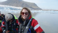
We weaved in and out of ice packs, making our way closer to the glacier wall. At one point, when the boat was stopped so we could take photos of an iceberg, the glacier let out a “boom” and calved a small iceberg. I didn’t see the ice falling, but I looked over in time to see the water splashing up and some ice fragments hanging in the air.

We got quite close to the glacier, but kept a safe distance. The guide fished out a small chunk of ice so we could hold five-hundred-year-old ice and get our pictures with it. He said it is pure ice and goes great with whiskey.
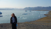
The entire tour lasted about forty-five minutes and was an amazing experience. We got out of our gear, and Meredith and I hurried to the cafe. It was 4:50, and they closed at 5:00, and there are no towns within fifty miles of the lagoons, so this was our only eating option we knew about. We grabbed the last two sandwiches that they had, and that was supper. Meredith commented that never before has she been so unsure of getting meals while touring Europe.

I wanted to go check into our room, which looked to be about ten minutes away on our map. Then we could return to see the big lagoon. The guesthouse turned out to be about thirty minutes away – the map had the location wrong. That meant thirty minutes there, checking in, and then thirty minutes back to where we had just come from. Mistakes happen sometimes when you travel.
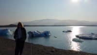
We did get back to Jokulsarlon, and we loved it. It is much bigger than the other lagoon, and the icebergs are huge. We both agreed the smaller lagoon has much more ice, but the ice that Jokulsarlon has is big. The sun was also low(ish) on the horizon, so the water and ice were glinting in the low sunlight. There were still a lot of people around, but not nearly so many as the parking lot could hold (and no buses). It was a quiet place of beauty, except for the two booms of distant calving that happened while we were there. We were too far away from the glacier to see anything, but you sure could hear it.
After a quick look across Route 1 to see where the river dumps the icebergs into the sea, we headed home for the evening. It was an early turn-in for us (8:30), but we have been touring hard and long for a few days now. Sometimes getting rest is not wasting time.
Iceland, July 2021, Day 10 (Tuesday), Egilsstadir Region

Given how tiring yesterday was and the late hour we got to sleep (after midnight), Meredith let us sleep in until 9:00. That was quite welcome. We had breakfast/lunch in a bookstore/cafe that was cute, and we were finally underway for touring around noon.

Mer warned me we would be doing some driving today, and that today was another somewhat “the journey is the destination” kind of day. We went south along the lake of the area, Lagarfljot (“River Lake” – it’s narrow), which also took us through Iceland’s national forest. Much of Iceland was deforested a long time ago, but in this region, Icelanders have regrown 280 square miles of forest. Combined with the lake and surrounding mountains, it was beautiful.

We crossed the lake at a narrow part on the southern edge, and we soon were driving up paved switchbacks to climb up to what I thought would be a pass. Instead, when we reached the top, we were greeted with a huge open plain with views of mountains in all directions. At some points we could even see a small part of Iceland’s largest glacier, Vatnajokull. This open space was not just a barren lava field, but instead was smooth spaces with some grasses growing.

We stopped for a very welcome bathroom stop at a surprise-to-us little hot spring and guesthouse place in the middle of this plain. We justified our use of the bathroom by buying some cake. I’m not sure who stays up there, but it sure felt remote.

We continued on the paved road, although I often hugged the middle line or crossed it a little, as the sides of the pavement were not always in great condition. That worked out okay, as we met only about one car every ten minutes.

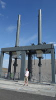
Despite “the journey being the destination,” we really did have a destination, and one that once again shows that Meredith loves me. We came to a huge dam called Karahnjukar that came online in 2007. The dam runs a six-hundred-megawatt power plant, which is used to run the Alcoa smelting plant in Iceland. Energy is so cheap in Iceland that it makes fiscal sense to ship old aluminum to Iceland, melt it down, and ship it back to other countries. To make this dam, eighteen hundred people worked on it for five years, drilling and blasting over thirty miles of tunnels to route water around. We got to chat with an engineer who happened to be outside, and he said they have six turbines that run continuously to keep the Alcoa plant supplied. He said the national grid can back them up to the tune of two of the six generators if they need to take them offline. That is amazing; by comparison, he said the transmission lines that supply the entire north of Iceland supply one hundred megawatts. The entire national grid can’t back up the dam – the smelting plant uses that much power.

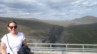
From the relative safety of the observation platform, we looked over the dam and surrounding mountains and crazy Swiss workers installing rock-catching fences on the opposite cliff. After ten days of hard hiking and treacherous footing, poor Meredith caught her foot on a normal step and fell hard, coming to within about one inch of hitting her teeth on a step. Never let your guard down in Iceland! We (and here I mean Meredith) had the option to walk along the pedestrian ledge of the dam all the way across. I walked “with” Meredith about ten feet below on the normal and safe sidewalk. We had great views of the canyon that is currently dry, but should have spillover water from the dam sometime next month as the glacier meltwaters fill the reservoir behind the dam. The pictures we saw made it look as if the waterfall from the spillway is something to see when running.

We spent about an hour at the dam, and then drove back the same way we had come. We could have kept going, making the journey a loop drive, and our Icelandic engineer said we would be fine, but the road that way becomes an “F road,” which in Iceland is an abbreviation for “Abandon all hope, ye who enter here.” Those roads are rated for four-wheel-drive vehicles only, and are forbidden in a rental car. We played it paved and safe, and we saw several things on the way back that we had not seen on the way out, in the usual Iceland 360 sort of way we have seen all along.

We went back to the guesthouse to regroup. It was a little after 5:00, and we decide to go have supper in a cute little town on a fjord called Seydisfjordur. Apart from the waterfall in the Westfjords, this was one place in Iceland I really wanted to see.

We drove up the pass on a paved road through several switchbacks. It came out in a pretty place of pretty snowy mountains feeding pretty lakes. We eventually came to the descent, and went down several switchbacks, loomed over on two sides by pretty mountains with dozens and dozens of pretty waterfalls. The town came into view, down in the pretty valley area. It was nestled up against a pretty fjord, with a pretty river running into a pretty lagoon near the pretty harbor, towered over by pretty cliffs on either side.

I pretty much had forgotten my camera. It was back in the hotel room.

We had an excellent meal sitting outside, with grand views as dining companions. After supper, we took the recommended guidebook walk, which took us around the lagoon and past the ferry terminal that serves the ferry to Denmark, a two-to-three-day trip. We ended up climbing part-way up the double waterfall at the edge of town, which gave us great views of the harbor, town, and mountains all around. It was picture perfect.

We headed back to our room, with a brief stop at a gas station to use a free car wash for the second time on this vacation. Iceland is hard on car exteriors.

Tomorrow we start to head directly south, along the eastern coastline. It’s a four-hour drive, according to Google Maps, so I figure closer to five, which makes for a longer driving day. I’d better get another good night’s sleep, and try to remember the camera this time.
Iceland, July 2021, Day 9 (Monday), Lake Myvatn to Egilsstadir

Travel is a blessing in itself in that it exposes you to new experiences and ideas. But travel also has a way of reminding you what is important, like being thankful. Sometimes, travel reminds you to be thankful for a hot dog.

We started the day off in Lake Myvatn, and on check-out from our room, our hostess recommended we go see Studlagil Canyon, which was on our way east. She said it resulted from a dam being built, and the lower water exposed the canyon just a couple of years ago, so it wasn’t in most guidebooks. She showed us a picture, and it looked pretty amazing, and I like taking advice from locals, so I filed that away as a place to go should we have time.
We first, however, drove a short way to the southern side of Lake Myvatn, to walk the Crater Trail. The trail weaves in and out of pseudocraters, which look like mini-volcanoes; they are the result of when lava hits water – the steam explosively escapes, and the magma builds up on itself. It was a cool but dry morning, and a farmer was out in his tractor aerating his hay while a small herd of horses grazed on a hill overlooking the lake, with a large volcanic crater in the background. It was a great place for a hike.

We took in all the cones; the crater trail only takes twenty minutes. We took an easy stroll down a longer path that went by the lake and caters to bird watchers. That path also still wound around some small craters, and it took about forty minutes to hike. That also got us to about 11:00, which was when a cafe we wanted to go to opened.

The cafe was at the trailheads of the Dimmuborgir lava fields. “Dimmuborgir” means “dark castles,” and these dark castles are huge columns of various lava formations. Local lore says they are trolls that turned to stone in the sunlight, and Meredith and I saw one that was pretty clearly troll-like on our walk. We got launched into the labyrinth after we had a hearty breakfast/lunch of all-you-can-eat soup and bread.

There are various trails, many of which are paved, in the Dimmuborgir area, and we studied a map of the system. I saw a dashed line that went right through the heart of the columns, so we took a paved trail to that trailhead. Which was marked, “Warning! Difficult trail!” I was pleased.

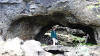
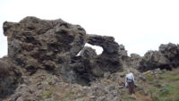
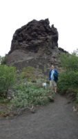
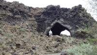
The trail wound all through arches and columns and caves and craters. We even saw some cracks in the ground that still had ice in them. The trail was tough, and went up and down and around craters and stones, but it was magnificent to be surrounded by such rough beauty. When we came out on the other side to a standard trail, I saw a sign for “Kirkja,” so I had to check it out. It was about a third of a mile away, and turned out to be a huge stone arch that looked a little like a vaulted church, thus presumably leading to its being called “Kirkja,” the Icelandic word for “church.” Good side trip. We headed back on an easy trail to the parking lot and headed out eastward on Route 1.

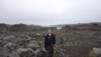
I decided that since Route 1 took us within twenty minutes of Iceland’s largest waterfall (by volume), Dettifoss, we should swing by. As we got close to the turnoff, it started to rain a light rain. We pressed on, figuring it might let up. We got to the parking lot, and it was still raining, so we broke out the Westfjords clothing and walked the mile to the falls. The last half of the trail was through basalt rocky areas, which were fascinating. So was Dettifoss – you can see the spray from the falls from the parking lot, which is about a half mile away in a straight line. The torrent of water was impressive. As always, I couldn’t get too close to the canyon edge to look down, but the roar was very loud, and the spray from the falls easily came back up over the canyon walls just north of us (on our side of the canyon, near a viewing platform). We walked around to get different angles on the falls, before we carefully walked up to the viewing platform. That was better – I could safely see down into some of the canyon. As we left, once we got away from the falls, we discovered it had more or less stopped raining – the mist we were getting hit with was all from the falls.

Because I was now wet and cold and had to use a bathroom, we skipped going south to the nearby (half a mile away) Selfoss falls, but we were very pleased that we could still see them from the trail as we walked back. We had missed them on the way out because we were facing the wrong direction. Iceland 360!

We got on the road just before 4:00, headed east again. This turned out to be the only fairly boring drive in Iceland that I have done. The road passed through uninhabited stone and rock fields, but rarely with anything interesting going on. After what seemed to be a long time, we saw the sign on the side of the road for Studlagil, the canyon our hostess had told us about. We turned down the road about 5:15, and I figured it would take us a half hour to get there (the Google map she had shown me did not seem to show it too far away), half an hour there, and half an hour out, which would have us to our guesthouse by 7:30. Late, but not too bad.

Then the road turned to gravel. Bad gravel – it was wash-boarded in many places, which shook the car quite a bit and slowed us down. We plowed on. We saw a signposted map and discovered that the canyon was sixteen km away (ten miles). No big deal. After a bit, I did the math and realized that this would take us thirty minutes at safe speeds, and we had already been driving a bit. We pressed on. We pulled off the dirt road into a small parking lot only to realize most trucks and jeeps were still going. We saw cars gleaming in the sun a couple of miles down the road, so we went across a bridge and onto this new road.

I should say “road.” It was really a tractor trail. And a one-lane one at that. But I felt that since we had so much time invested, we should push on, and the road was only a couple of miles long. We safely reached a full parking lot, so I parked on the side of the road, safely out of the way. We had made it! It had taken much longer than I’d thought it would, but we would walk to see the canyon and then be on our way.

We started walking, encouraged by the steady flow of people coming back in the other direction. We knew that we were on the right path and that many people thought it was worth seeing. The footing was rough – coarse gavel, newly put down, so it felt like walking in coarse sand, which is hard. We trudged on for some time, and I finally asked a man how much further. He told me about thirty minutes, but that it was a good viewing point. By now, I definitely had too much time invested to turn around, so we went on. And on. And on. Turns out, from where we parked to the canyon was two miles.

And just as you start to see the canyon, you can also see the observation deck on the other side of the canyon. The one with the metal stairs. The metal stairs that lead to the road. The dirt road I had been on an hour, and two miles of hard hiking, before. I was a little put out by that revelation.

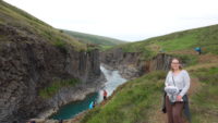
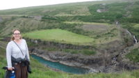
The good news is that the canyon is beautiful, and our non-road side was the better one for viewing. The observation deck side was taller than ours, so we could see more of the basalt columns that were on that side of the canyon. Additionally, we could wander around on our side all over, finding different viewpoints. Some people even climbed down to the river level, and we saw at least two people jump in for a (quick) swim. We hung out there for some time, and hiked out.

By the time we got back to the car, it was 7:30. And we still had to drive out and get to town. Many things in Iceland close at 8:00, and almost everything closes by 9:00. We began to brace ourselves that we might be going hungry tonight.

We got near to town. I had no specific idea where our guesthouse was, and I wasn’t sure if we would find anything open to go in and ask. So I prayed that we would find it, and as soon as I stopped praying, Meredith saw a sign for it on the side of the road. Thank you, Lord. Travel can teach thankfulness. We skipped the room and drove straight into town to see if we could catch something open for food.

We saw a Subway with people inside. It was 9:07, and we went in, only to be told they were closed. We saw a nearby N1 gas station with attached store, so we went there figuring we could at least pick up some snack food. It was mobbed with cars, and had a restaurant attached. We were going to get supper after all! We were looking at the menu when a man told us the kitchen closed at 9:00. Sigh. We figured we could still get snack food, when we saw some pizza in a glass case, for selling by the slice.

We got in line. We were going to get pizza! We were fourth in line. The woman at the front had a bunch of stuff, and then at the end pointed at a bunch of different pieces of the pizza. All but four pieces gone. That was still okay. The next woman asked for two pieces. Two left. That was okay – we saw two hot dogs left as well, so we could get pizza and hot dogs. Then a man who wasn’t in line asked the clerk behind the counter for a hot dog. This was getting rough.

We got to the front of the line and asked for the pizza and if we could have two hot dogs. I asked just out of desperation. Turns out they have a bin of warm water hot dogs in waiting (Icelanders love hot dogs, so I have been told). So we had two pieces of pizza and two hot dogs.

We ate with real gratitude. We hadn’t eaten since noon, and it was now about 9:30. We had walked fourteen miles (according to my watch), and driven for couple of hours on good roads and over an hour on rough roads. We were tired and hungry, and we were thankful for gas station pizza and hot dogs. And we still are.

Travel makes you keenly aware of your need for kind people and for God’s provision. That is one of many reasons we keep doing it.

Iceland, July 2021, Day 8 (Sunday), Trollaskagi Peninsula to Lake Myvatn

Yesterday, we kept reminding ourselves that sometimes the journey is the destination. Today, that really was the case for much of the day. When I decided to stay in Hofsos, I asked Meredith if I could intrude on her plans for today a little by finishing the drive around the Trollaskagi Peninsula, which is supposed to be one of the prettiest drives in Iceland. Happily, she agreed, as long as she could do the two things she had planned for the Lake Myvatn area. I told her she could push one of them into Monday if needed, and so we were set to go the scenic way around.

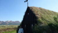
But first, we needed to backtrack a little bit. Just south of Hofsos, about two miles away, is a turf church, with wooden end walls, but with a turf roof that goes from the apex of the structure all the way to the ground. We had missed it on the drive the night before, which is no surprise since it turned out to have a sheep gate across the access drive. It’s easy to open, but not something we would have seen after a long day of driving. We found it, and parked in the small lot near the church, but had to traverse a field to get to the site itself. No big deal, but we did seem to disturb some birds, which isn’t a joke in Iceland. If they are arctic terns during mating season, they can be very aggressive. These weren’t, but it was a couple hundred tense yards to the wall of the church, which was also made of turf. The enclosed cemetery still seems to be used on occasion, with the most recent headstone dating from 2003. With the snowy mountains in the background, it was a lovely spot.

Back on the road, we headed north. The drive did not disappoint. Soon after Hofsos, we turned a corner, and a whole line of majestic mountains, with heavy snow still on the peaks, came into view, all over a fjord. It was an amazing sight, and one that was with us for a decent part of the drive. I’m afraid I didn’t get any pictures of it – Iceland can have long stretches of road with nowhere to pull off, so getting photos is difficult or impossible in places.

As we neared the northern point on the peninsula, and the pretty town of Siglufjordur, we encountered a one-way tunnel. Happily, for my driving sanity, we had the right of way. Cars coming in the other direction had to pull into carved-out nooks spaced every hundred meters. It seemed stressful, but since I had the right of way, and the tunnel was fairly short, it worked out fine.

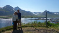
Just as we were pulling into Siglufjordur, there was a small pull-out. I stopped so I could look around and take a photo of the pretty spot, when I noticed a viewing platform above the parking area. Meredith had seen it, but hadn’t decided if I needed to know about it more than she need not to climb. Up we went. The path wasn’t marked, and so we made one wrong turn, but we eventually made it to the platform. What a view, and, in Meredith’s term, Iceland-360; there was beauty in every direction. There were  snowy mountains in front of us, a rocky mountain behind us, a fjord right below us, and the mountain-framed town to our right. You could hear a small stream from the mountain behind us, and a gentle breeze was blowing. The air was clear and clean and had a hint of flowers and cut hey in it. I told Meredith that the platform was probably my favorite spot in all of Iceland (to date). We stayed up there for twenty minutes or more.

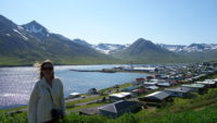
The town of Siglufjordur is quite cute, with a large church and a small square and friendly avalanche-catching fences up on the mountains around town. We finally ate breakfast and lunch (combined – most eateries don’t open until noon on Sunday) in a small restaurant, and then stockpiled some large cinnamon rolls for later consumption. As an aside, Siglufjordur is our personal record for northern latitude, at only about forty miles south of the arctic circle. I loved the town.

Leaving town was still beautiful and exciting – we went through the longest tunnel I’ve ever gone thought, at 1.8 miles long. Five hundred yards later we entered a four-mile-long tunnel. That was followed by another village on a fjord and surrounded by mountains, and then we got another one-way tunnel. We again had the right of way, which was good since this one was over two miles long. Playing tunnel Frogger going the other way did not look to be much fun. If you ever visit the Troll Peninsula, make SURE to do it in a clockwise direction!

We rejoined Route 1 and made our way to Lake Myvatn. Over the drive, the landscape changed from rolling farm fields with scenic mountains to a blasted landscape of lava fields and scrubby bushes. My introduction to the lake was a small series of cones that looked like fifteen-foot craters (they are actually magma tubes that cooled off quickly). The lake is lovely, but the area around it is undeniably hostile looking. We checked into our guesthouse, and got situated. Meredith, the merciless taskmaster, insisted we tour on, and so we drove a short distance to the Myvatn Nature Baths. Touring is hard.

Myvatn sits on a fault, and so there are a lot of things going on here, thermal-wise. This, according to a write-up in our room, was where Iceland’s first geothermal plant was built. Near the plant are the baths, which, while not so large as the famous Blue Lagoon, are still really big and really nice, and cost half as much. We checked in and got into the bath with our new closest two hundred friends, and soaked away. The temperature of the water varied naturally in the large irregular pool, and so we wandered the whole pool to find a good spot.

I voted for one that was both very warm, which felt good, but also was somewhat in the shade. I saw several pasty northern Europeans in various stages of severe sunburn, so I wanted to be careful. I think I succeeded, and we spent a happy and relaxing couple of hours in the pool before having supper at the cafe there.

Meredith said we could head back to our guesthouse, since it was now 8:00, but also said her second sight was close by. I thought we should at least check it out to see if it could be done in an hour or so. I’m glad I did. First, we got a great view of the entire Lake Myvatn area from an overlook at the top of a small mountain pass. That was a nice bonus. But on the other side of the hill was something I had not anticipated – Namafjall, a blasted wasteland of hot springs and boiling mud pits.

The area strictly warns you to stay on the paths since the ground around the springs and pits is unstable. The springs are boiling hot, and the mud pits are also boiling, with the bonus of being made up of sulfuric acid. I stayed on the paths. It turns out to be an unsettling thing to hear the “blurp” of boiling ground. I also avoided the steam of the largest vents, fearing it might still be dangerously hot. But it was a beautiful place, in a bleak way. It was certainly something way outside my experience.

After about an hour, we headed back to the hotel for the night. One of the benefits to being in a thermal hot spot area is there is tons of hot water. Good for thermal baths, of course, but our bathroom encourages a “power shower” to highlight the green energy of the area. I’m planning on taking it to mean taking a long shower in the morning, to help melt away the stress of my beautiful day today.

Iceland, July 2021, Day 7 (Saturday), Westfjords to Hofsos

As Meredith likes to say, especially in Iceland, sometimes the journey is the destination. Of course, the destination usually has my bed, but she is right that seeing the scenery here is special. And some days it has to be, because on long country-wide road trips, some days are travel days.

We had to get from our hotel in the far west of the Westfjords to the small village of Hofsos in the north central part of the country. I was worried at first, as our hotel was fogged in, and the roads in the Westfjords are already slow and require careful driving. Happily, once we were underway, the fog lifted in about two miles, and we had a brilliantly sunny day the entire day. Even so, it took four hours to leave the Westfjords. We did have one quick stop for a light lunch, and we could even sit outside to eat. It was a pretty place, so that made for a good stop.

Even out of the Westfjords, it took another five hours to get to Hofsos, which included a supper stop (in a less pretty interior of an Iceland restaurant). But the sun continued to shine, and we drove around a dozen different fjords today and four different mountain passes. We saw fjord-style layer cliffs, “normal” mountains, and mountains that looked as if they’d all had their tops cut off by a giant. We saw pretty streams and quite a few mountains with snow still on them, and saw sheep and ponies aplenty.

The reason we are spending the night in Hofsos is three-fold. One, Meredith wants to be at Lake Myvatn by tomorrow evening, so we needed to get to the general area of north-central Iceland today. Two, Hofsos is on Route 76, which a couple of guides have marked as maybe the prettiest drive in Iceland. Three, Hofsos has an amazing infinity pool and hot tub.

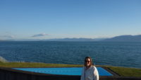
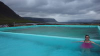
Two successful businesswomen donated the pool complex to the tiny village of 190 people. It is beautiful in and of itself (I am fond of infinity pools), but it also looks out directly over a fjord at a mountain range. Add in a ton of sunshine, and we had a really great swim and soak. We stayed in the pool/hot tub for about an hour (until 8:30 – they closed at 9:00). It was very much a community place, with many people speaking Icelandic. We also heard English, French, and some Slavic language (maybe Polish?). We have now been in high-end spa pools, good community pools, and rustic pools. They are all nice. Iceland does know how to do a good hot pool.

After our pool session, we dropped our wet stuff in the room, and walked around the town. We lingered at the church and the cemetery, and we relaxed in the warm air looking at the snow in the mountains (two mountains nearby still have solid snow tops). And now, my destination is bed.

Iceland, July 2021, Day 6 (Friday), Westfjords

Captain’s log: Objective obscured by low clouds. Rain starting. Morale falling. Pulled back to reorganize. Issued one and a half rations to party to boost morale.

Distances in the Westfjords are not particularly vast, but they might as well be. Between roads being fitted in around fjords and some roads being in part or whole made of dirt, it takes a long time to get anywhere. For instance, it is an hour from our hotel to the nearest town, which is about fifteen miles as the crow (or puffin) flies. Just to get from the hotel to a paved road takes forty minutes.

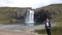
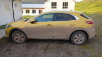
All of this is relevant to what I wanted to see today, and what was my primary reason for coming to the Westfjords – the giant bridal veil falls of Dynjandi. It is located on the only road connecting the southern part of the Westfjords to the northern part. And it is gravel for fifty-plus miles of the way. And when we woke up today, there was a light but steady rain. Which, when mixed with gravel, does an impressive job of turning a, say, yellow car into a brown car.

Dynjandi is about eighty miles from our hotel, but it took us almost three hours to get there. We did detour thirty minutes into the town of Patreksfjordur to fill up on gas, just to be safe. We probably had enough gas (a half tank), but you really don’t want to risk running out of gas in an entire region that, as Mer pointed out after looking at a local map, has more public swimming pools (seventeen) than gas stations (eleven).

The drive was an Icelandic version of Brigajoondur – we quickly drove up into a cloudy mist, from which things would emerge and then disappear. A few places had mist so dense I could only see far enough ahead to see one set of yellow road markers on the side of the road, which are not that far apart. Then the mist would part, and we would see snow-dappled mountains or a dramatic valley view, and then we’d be in mist again.

Making it to Dynjandi, we discovered that the several lower falls were clear, but Dynjandi itself was about half shrouded in mist. We decided to hike up to it anyway, since we had come all this way, and we’d had good luck previously with rain or clouds clearing up when we got to a sight. We climbed as high as the third smaller fall (about a quarter of the way up) when a light rain started to fall. Also, our friends the Icelandic midges were back in force. So we retreated back to the car to eat our emergency stash of Snickers, to plan, and to (hopefully) wait out the rain.

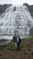
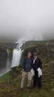
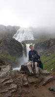
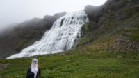
After about fifteen minutes, we thought the rain was lightening up, so we got out and got geared up – hats for rain, and netting for our faces if needed for the midges. We started our hike up the path again, and the rain stopped, and Dynjandi started to appear out of the mist. What a sight! It was huge and wide and multilayered and spread across a vast amount of rock face. There were a few people up near the falls, and the perspective their scale gave to the scene was almost dizzying. As we climbed, Meredith put on her white netting, calling it her bridal veil for the bridal veil falls. The midges were thick, but I resisted cranking up my personal nerd space with a face netting until I was halfway down. When we did eventually reach the top of the trail, at the base of Dynjandi, the wind and spray from the falls kept any midges away.

What a joy to hike the falls trail – some of the lower-down falls we thought were small turned out to be fairly big, but had been obscured by rock faces when seen from down lower. The higher we climbed, the more we could also turn around and admire the fjord that was now clearing out of the mist.

But, no question, Dynjandi stole the show. Even with the mist and the breeze and the roar of the water, we spent about half an hour up near the falls, just trying to drink it all in. As we started to climb down, the mist crept back in, making the falls hard to see. We felt as if we had been lucky to see what we had seen, but when we got about halfway down, the sun started to burn away the mist, and the falls came splendidly back into view. Even once we were back in the car, we sat watching the falls for a few minutes before heading back over the pass to go back south. Dynjandi had been my major motivation for coming to this part of Iceland, and not even a two-to-three-hour drive lessened my awe of the falls.

The drive back seemed to go much more quickly, which is often the way, in my experience. The weather was better, so we had better views of the sights around us; Meredith had grand views, since she could look around. I was more focused on staying on the road and avoiding the occasional oncoming cars.

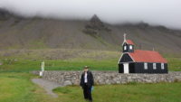
We headed back toward the hotel on the Latrabjarg peninsula area, but I detoured south down a (of course) gravel road to go to a large sand beach named Raudisandur. It was supposed to be huge and covered in brown sand, which is rare in Iceland. The drive didn’t seem too bad, but then we hit some true switchbacks up and down the pass, with a few please-don’t-let-there-be-another-car-coming places. We made it safely, and I admit to being a little disappointed in the beach itself. The area where we were was covered in many places by shallow pools, even though it was low tide. That made walking the beach a less inviting proposition. But the surrounding cliffs were amazing, and there was a black church near the beach, and the churchyard was open. So we poked around, looking at gravestones. I had forgotten that Icelanders are so-and-so’s son or so-and-so’s daughter as a last name (so Matthew Peterson or Meredith Dalesdaughter), even for married couples. Most of the tombstones listed where the person was from as well. It was a peaceful spot. But, as it looked as if clouds were forming around the mountain, I decided we should leave so I wouldn’t have extra trouble on the road out. It did start raining lightly on the way up, but in that odd Icelandic way, by the time we got down and just a few miles along toward our hotel, the sun finally came fully out, for the first time since we have been in Iceland. What a glorious sight it was to see all the fjords lit up brilliantly.

We ate supper at the hotel, before heading out on the gravel road down the rest of the peninsula, to get to the Latrabjarg cliffs, which is a series of cliffs that are the nesting ground to about one million birds. We were going to go last night, but the weather was bad, so we delayed it until today. A couple who had gone last night had shown us their puffin bird pictures at breakfast this morning, so although the couple had gotten soaked, they had gotten very close to the puffins.

In comparison, we felt a little smug going to the cliffs tonight, with our expanse of sunlight. But it seems that puffins like rain more than wind. When we got to the cliffs, there was a strong wind we had not had anywhere else during the day. The sun was out, but there were no birds on the ground. There were many in the air, and, if we could judge from the photographers too close to the cliff edge, there were many on the cliffs. However, we didn’t get to see any puffins up close. But it was a beautiful place to walk, until the path got too close the the cliff edge. Then my fear of heights kicked in, and I left Meredith to continue on while I beat a discretionary path back to the car. Mer met me there about fifteen minutes later, and we came back to our room. We threw open our window, which looks directly out to the ocean over a couple hundred yards of grass. We can hear the surf crashing on shore as cool air drifts in. Sometimes the sun does come out, but even so, the morale-boosting rations are still tasty.

Iceland, July 2021, Day 5 (Thursday), Westfjords

Who could have predicted that a place called the Westfjords would have many, many fjords? And that driving around many, many fjords takes many, many hours? Someone should really warn me about these things, but I get ahead of myself.

We left Snaefellsnes Peninsula this morning in a typical way for our two days there – right where we were staying and parked was dry, but on both sides of the town, you could see rain bands. It had the happy effect of throwing a rainbow across the iconic mountian Kirkjufell, which we could see from our room and as we loaded the car. The trip out involved going the same way we came in, over a mountain pass. The views were better today, but the top was still rainy and cloud-bound.

We had a choice on how to go out of the peninsula – we could take the dirt road due east, or drive south on the paved road back to Borgarnes before turning north again to head to our destination of the day, the remote Westfjords region. We decided to play it safe, and we took the paved way, even though it may have added thirty minutes or more to our trip. Dirt roads in Iceland can be anything from great and fast to rutted and slow. We knew we had plenty of dirt roads ahead, so we took the road more traveled. It also allowed us to eat at the bakery in Borgarnes one more time, so that was a bonus.

We both had decided to go to the Westfjords independently during the planning process. Mer wanted to go because Rick Steves covers it and it sounded wild and far-flung, and I saw it on a map and thought, “That looks cool!” When I found out there was a major waterfall overlooking a fjord in the area, I was sold.

The thing about being far-flung is that it takes time to get there, sort of. It is no problem getting to the edge of the Westfjords. It is getting into them that takes time. If you skip the ferry, which we did since it wasn’t leaving until 3:00 pm, then you have to take the one road in, Route 60. Route 60 weaves in and out of eight different fjords and over several mountains, and has the exciting bonus of being a dirt road for about twenty miles. Iceland, being a manly country, doesn’t usually believe in guardrails over silly things like steep drops into fjords, so it makes for some…interesting…driving. When there ARE guardrails, worry.
We got past the eight fjords, and, tired of the boring paved road, Meredith had me turn to stay on Route 60, which again became a dirt road, this time with the added bonus of being under construction. Once past the construction, we turned down, or rather, up and down, Route 63, which was a dirt road in and out of fjords and over mountains, but with the level-up challenge of usually being less than two lanes wide. Natives in four-by-fours do like to keep as close to the 80 kph (48 mph) speed limit as they can on these roads, so I was paying more attention to the driving than to the astonishing scenery around me. I was impressed and moved by whatever happened to flash in front of me, except when the road commanded all of my attention. Meredith loved the drive for the scenery.
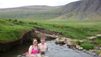
The result of all of this out-of-the-way driving was that we stopped in a small parking lot next to three small buildings and an outdoor pool that overlooked the mountains and a fjord. The property had a natural hot spring, and the soak-loving Icelanders had built a pool that was free to use. You didn’t even have to shower before using it. We changed and got into the pool, which was about the temperature of warm bathwater. You wanted to keep as much of your body submerged as possible, as the winds were blowing and were cold, but that added to the experience. We soaked in the water and the scenery as well for some time. There was also the natural spring itself about a hundred yards up the hill, so we went to sit in that, despite getting chilled some from the wind in the process of walking there.
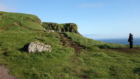
It was worth it – the natural pool was sandy and really hot, much hotter than the swimming pool. There were two women soaking their feet there, and as we got in, a man and woman came up to soak their feet as well. The two women were from Germany and were at the tail end of their trip, and the man and woman were originally from India, but now living in San Francisco, and were at the end of their trip. We sat around and swapped stories, all while enjoying the hot pool. When we all got up to leave, Meredith and I took another dip in the pool to rinse off any sand, and we dried off and changed back into our clothes.

We drove on very pretty roads, which shorty turned back to paved, all the way to the small town of Patreksfjordur. We had looked into staying there while planning the trip, but everything was booked. So we went on around another fjord, along Route 612 west (unpaved), until we got to our hotel. By then, I was very weary and hungry. In addition to the to the road conditions, it had started to rain lightly. I was relieved to get out of the car.

The hotel is surprisingly big, with an annex and a small campground. Only about four or five miles away is the westernmost point of Europe, which also happens to be a puffin breading ground. We have been told these puffins are pretty fearless, letting people get to within a few feet of them. My guess is the hotel is here to cater to bird watchers. We were going to go out to see the puffins tonight, but the weather is poor and is forecast to clear by tomorrow evening, so we delayed the trip. We had an excellent supper and got settled in our own nest for the evening.

Iceland, July 2021, Day 4 (Wednesday), Snaefellsnes Peninsula

Matt decides to outsmart Iceland and puts on the spandex shirt he brought as an underlayer. THAT will keep Matt warm. Iceland turns down the heat….

The day ultimately ended up being good, weather-wise, but the morning was windy, cold, raw, and in some places rainy. The first two stops we made were really cold, seeps-inside-you cold. And I was wearing five layers. In July. After the second stop, the day started to warm up, and the winds dropped down to more normal, so we were fine, but I originally thought we were in for a long day.

Which was my day to be in charge. We took our time getting ready this morning and had a long breakfast because we were waiting for the local supermarket to open at 9:00 to see if they had a SIM card for a phone and a box of tissues. In an Icelandic town of 900 people, think less supermarket and more large convenience store. They didn’t have a SIM card; no surprise. They also didn’t have tissues. We thought maybe the attached pharmacy might have tissues, but they didn’t open until noon. We decided to make do with a roll of toilet paper we snagged from our room.

My days tend to be a mixture of planned sightseeing and “where does this road go?” whimsical moments. Our first stop was whimsical – a pull-off on a high point of the road going west. The views of the next town and surrounding countryside were great, but it was the first of our two really cold stops. The second was a somewhat-planned stop in that I had seen it online and filed it away. When I saw the pretty red church situated in a mountain-surrounded field, I knew I wanted to stop.

So I turned down the dirt road to go it. The car was immediately dive-bombed by an arctic tern; they get aggressive during mating season. I bumped along with the road getting rougher, and I decided this couldn’t be right. I stopped and asked a man who was taking pictures of wildflowers how to get to the church. He said it was the next road. The tern dive-bombed us again on the return drive.

The church was worth a stop. There were good views in all directions, even with the low-lying clouds covering the tops of mountains and, sadly for us, the nearby glacier. All day long, we would get small glimpses of the glacier, but never the whole thing. We started calling this phenomenon “The Dance of the Seven Clouds.” Anyway, we took our time and some pictures at the church, which was the last really cold stop of the day.

I had wanted to see a small (by Iceland standards) waterfall named Svodufoss. It is “only” 35 feet tall, but is situated well with the glacier above it and mountains around. Iceland seems to be stepping up both the environmental as well as the tourism game by installing plastic pavement grids filled with crushed stone to serve as paths for visitors. That makes hikes dry and easy, and protects the fragile plant life next to the paths. The locals had installed one of these at Svodufoss, as well as a stone wall/bench area with a stone patio that allowed us to sit and watch the falls, which we did for about ten minutes.

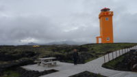
We made a snack/pit stop at the cute cafe we had eaten at yesterday, and then went back into the Snaefellsjokull National Park on the western part of the peninsula. We went down a one-track paved road that became an okay dirt road that became a rough dirt road. At the end of the road, separated by a mile or so, are two colorfully orange-painted lighthouses. Both are surrounded by lava fields, but the first one we went to is about thirty feet tall and has the mountains as a backdrop. I really liked that one. The second lighthouse is pint-sized, being maybe ten feet tall, and on the edge of a grassy area. In the middle of the grassy area is the area’s only freshwater well, which locals used to believe was a mixture of water, holy water, and ale. The well is still accessible for anyone who is interested, but bring a cell phone or flashlight – it’s dark in the mound built over it. The coast at this lighthouse lets you look back east over the rest of the peninsula, which was impressive today as the waves were crashing all along the coast as far as we could see.

A return bumpy trip got us back to the parking lot at the head of the one-lane road, where we parked to see Skardsvik Beach, a rare brown sand beach in Iceland. Most of the beaches are made of black pebbles or sand. I’m not sure where the brown sand came from, but we strolled around the small beach and loved how it was framed by black lava all around.

The day before, Meredith had been in charge and had taken us to the southern part of the peninsula, where we zoomed by two huge sea stacks without stopping. I clearly needed to fix that today, so we stopped by the Gestastofa Visitors Center, which is near the sea stacks and overlooks them (and you can hike to them as well). We used the free bathrooms (no joke in Iceland, where facilities are few and far between), and then walked over to the black lava cliff overlooking the sea (but not the stacks, which are in another direction). Again, we were impressed at the power of the waves crashing into the rocks. We then did walk most of the way out to the sea stacks, but stopped short of them, as we could see them better from a small distance.

We didn’t go far, however. About a mile down the road from the visitors’ center was a cliff overlook that was built (the overlook, not the cliffs) to see the stacks, but also had great views of the nesting seabirds on the cliffs below. It was a great stop; plus, as a bonus, the sun had come out some, so we could shed layers. The glacier was still stubbornly hiding under clouds, but we were warm (I think it was 52 degrees out, according to my car).

I was very proud of Meredith at my last stop for the day. We pulled into the parking lot for the Raudfeldsgja Gorge, and we started the climb up to the gorge entrance, which is a good little hike. The surrounding cliffs and mountains and ocean views were spectacular, so rest stops were never a bad thing. But, once we got to the mouth of the gorge, we found that it was only a few feet wide, all of which were taken up by a shallow stream. And Meredith actually waded it in her new Gore-Tex hiking shoes. I don’t take that for granted. We got into a roofless antechamber of sorts where there was some dry land, but that ended quickly. I scouted ahead to see how hard the hike was, and I turned around when I saw that it involved scrambling up small waterfalls. In the process of my turning around, the water came over the back of my right shoe. Ooops.

We hiked back down and then took the same mountain pass we took yesterday. The top was still covered in clouds, but the views going up were enjoyed by Meredith (who could look around) and by both of us on the way down (when the views were in front of us). We went back to the guesthouse, ate a quick supper, and then took advantage of the lack of rain to walk down to the small harbor of the town so I could see the mountains loom over the harbor and fishing boats.

There are several things to do and places to see here that I would love to have fit in, but they will have to wait. One of the great things about travel is how there is always more to do than time to fit it in, so you always have a reason to come back. That, and sometimes when you are really cold, the sun comes out and the touring goes on.

Iceland, July 2021, Day 3 (Tuesday), Grundarfjorthur and Snaefellsness Peninsula

“Ah, you silly Americans!” says Iceland in good English with a cute accent. “You think you got some wind yesterday? Ha! I’ll show you wind!” And so Iceland did. I have never felt sustained winds like those we encountered today. We know for sure (based on weather data) that one place we were had sustained winds of 38 mph. We’re pretty sure that on top of a volcanic crater in the middle of a lava plain facing the ocean, we must have had sustained winds of 50 mph. It totally messed with my windblown hair.

But I get ahead of myself. We got to the Snaefellsness Peninsula early, and headed to the northeast part of the area (the land overall juts into the ocean into the west, so this was the “upper right” part). We were again amazed at Iceland weather. Everyone not in California or Florida always says, “If you don’t like the weather, wait a minute.” These people have not been to Iceland. Coming from the south, in the space of about fifty miles, we had areas of misting rain, clearing, real rain, clearing, and misting rain again. We came over a mountain pass to get to the northeast, and we pulled over at a viewpoint to enjoy the view and to eat some brownies we had brought from the bakery in Borgarnes. When we got there, it was cloudy with patches of sun, but very windy. Then it clouded over. Then it started to mist and we got back in the car. Then it rained hard. I think we were stopped for less than ten minutes. When we drove away, we drove out of the rain within three or four miles. The end result of the constantly changing weather was that we decided just to tour and assume things would work out. Generally, they did, with any rain we encountered usually stopping after a few minutes of our arriving at a place we wanted to see.

Back to the northeast part of the peninsula. We pulled off on a side road at a sign proclaiming “The Shark Museum,” a museum showing how shark is caught and processed, and offering a taste of shark to tourists. But we were there about thirty minutes early, so I took the opportunity to drive a small dirt ring road along the ocean. It was sunny, but there was mist blowing in from the mountains, so we saw the brightest and closest (and full) rainbow either of us had ever seen. We saw multiple rainbows today, but this early one was spectacular.

We got to the museum a little after 10:00, and it was very much a family affair. The museum itself was one large room with family artifacts and a short video showing how they process shark. The same family has been catching Greenland sharks since about 1600. The sharks used to be caught for their liver oil (a Greenland shark liver weighs about 300 pounds), but the meat made people ill, until they buried it for six weeks and then dried it. I can imagine how that went:

“Gunnar! Every time I eat shark it makes me sick!”
“I know, Einar! It is too bad. We have so much meat.”
“Gunnar! If it makes me sick when it is fresh, maybe it will be okay to eat if I bury it in the ground for six weeks!”
“Einar! You are a genius! But, to be safe, after you dig it up from the ground, you should hang it in the air for three months, and then try eating it.”

Obviously, this is fictional. The original conversation would have been in Icelandic.


The motherly figure showing us around was very friendly, and when she got to the tasting, she acted as if of course we wanted some shark. Because she was so nice, and because it would shame Meredith into eating some, I actually tried a small piece. It was, technically speaking, not good. I saw a “tourist reaction” sheet at the door that showed the touristic stages of trying shark, and it ended with, “What in the name of all that is holy and good is that taste?” I agree with that sentiment.

Meredith thought it was okay.

After a quick photo stop of the small church on the farm, we headed along the main road going west, until we got to our first major waterfall on the peninsula, Grundarfoss. Grundarfoss is a large waterfall cascading 200 feet off of a mountain, with a dramatic ridge framing one side. You can walk up fairly close to the falls through a sheep pasture, with a walk of about three quarters of a mile. That involved jumping a small creek. Happily, at that point, we were committed, so Meredith successfully tried the leap. The rain let up as we got to the falls, and the wind died down considerably, so we spent a good ten minutes there looking around. As Meredith likes to say, Iceland is a 360-degree country:  there are views in all directions. As we wandered out, the wind and rain came back, so we were happy to get back to the car and the heated seats. I’ve not before given thought to wind chill temperatures in July, but I have now. For those curious, 50 degrees with 35 mph winds feels like 41, which I think feels even colder when you get wet.

We drove the short distance to the town of Grundarfjorthur, where we would be staying the next two nights. No one was in at our hotel; we’ve been worried at the increase in numbers of places that have check-in via a “call us” number posted, especially since the cell phone we keep in our car is a U.S.-only plan – it doesn’t work in Iceland, so that may make things harder as we go along. For now, we moved on out of town to a highly visited falls/mountain combination – Kirkjufell (the mountain) and Kirkjufellfoss (the falls).

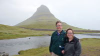
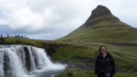
You can hike out to the falls from a parking lot, and get a picture of the falls and a dramatic stand-alone mountain in the same shot. It is on tons of post cards, and has been used (so Meredith tells me via Rick Steves) in the Game of Thrones TV series. It is easy to see why – even in the on-again, off-again mist we were in, it was a beautiful spot. There were mountains around, the falls, the lone mountain, the town spread out, and the ocean.

After lunch at a very cute café on down the road, we continued our whirl-windy tour by stopping at the Saxholl volcanic crater. Saxholl is a fairly small mountain at 300 feet, but it towers above the lava plains around it, and is open to the sea. There are also stairs that let you climb to the top. So up we went, even in the ever increasing wind. It was a fairly happening place, with a dozen or so cars in the lot. We met some people coming down, so when we got to the wind-tunnel top, there were about eight of us up there. We were all laughing at having to brace against strong wind gusts above the normal gale. It was indeed a bracing experience. The views were grand, but there was something about feeling the power of nature on top of a former power of nature that made us a little giddy.

On to another volcanic crater, but a less active one for us. The Holaholar Crater is one you can actually drive into. There are no views of the surrounding country, but the road takes you to a spot that creates a wonderful frame of the mountains as backdrop outside the crater.

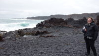
Djupalonssandur, a black sand beach, was next on the list. A surprisingly full parking lot was at the end of a mile-long single-track road. I knew from the crowds and the first collection of sight-attached free bathrooms that we were somewhere important to the local economy. A dramatic path led down through a lava field to a beach of black lava pebbles and sand. The crashing surf was wrapped on each side by huge rock formations and cliffs. It was raining steadily as we walked down to the beach, but let up after a couple of minutes down there. We lingered for ten minutes or so, and went back on another path. Before we went back to the car, we climbed a boardwalk to the top of an observation platform on a hill overlooking the beach for a grand view of where we had been.

You may think this sounds like a full day, and it was, but Meredith was in charge, so we had another stop. After a quick stop at a commemorative statue to a local woman whom the sagas say traveled as far as North America (where she gave birth to a child) and to Rome, we finished the day at Arnarstapi. Arnarstapi is a small collection of buildings near a very small harbor, but it boasts some great boardwalk walks along the edges of cliffs where arctic terns nest and where you get grand views of rock formations. We walked the boardwalks, and Meredith decided we could take the cliff walk to the small village of Hellnar. Rick Steves recommended it, and it started out on an easy path. That gave way at the lava field to a rough path of fist-sized stones. Add in some drizzle and rain and wind, and the walk was tough at times. It all cleared up at the far end, and the sun even came out a little for the return walk, which seemed much shorter. Happily, Iceland threw in some more drizzle right at the end so that we would appreciate our car’s heated seats.

We came back to town over another mountain pass, but this one was cloud/mist-bound, so we didn’t see to much. Our hotel was still locked and unstaffed, but a kind woman at a restaurant let us use her cell phone, so we got checked in okay. Some food at 8:00 pm helped shore up morale.

It was a long but good day. Touring around is wonderful and beautiful, but it ain’t no breeze.


Iceland, July 2021, Day 2 (Monday), Borgarnes area

Today we got introduced to three Icelandic things that we will almost certainly experience again on this trip – wind, water, and wings (in the form of midges). But don’t let the wild words worry you with waning willpower; we didn’t.

We started the day off with a lovely drive to the northeast to a rural area that features the most powerful hot spring in Europe, named Deildartunguhver. Easy for me to say. You can know in your head that hot spots in the Earth’s crust exist, and you can know the heat from those spots can heat water, but it is a mighty thing to stand in front of a hot spring where water is literally boiling and steaming out of the ground to form pools that would scald you. Deildartunguhver supplies the town of Borgarnes with all of its hot water, and happily for me and Meredith, someone built a beautiful spa on the grounds to take advantage of the spring.

We visited the hot springs (which is wisely fenced off and posted with warning signs) and stood in the clouds of steam issuing up from the spring. We would be cool one second (standing in the fifty-five degree air), and then in one step, we were standing in warm steam. Just a couple of feet made a drastic difference. We scouted out the spa area; the hot pools are outside and visible from the walkway, but we were there about forty minutes before they opened, so we took a chance to explore.

We went back to a roadside sign I had seen, and it turned out to explain about the area we were in, with a map as well. We walked across the street to a dirt road to look at a very involved road map, and I decided to take a picture of Meredith with the mountains in the background. I stepped back onto the dirt road to take the photo – no big deal. A dirt road off of a tar road that would see one car every five minutes. So, of course, as I took the picture, a car turned off the tar road onto the dirt road. We got back in the car to go look at a church marked on the map, seeing a John Deere tractor along the way being driven by a mom with her son in the cab with her. The church was very small, and in a beautiful location, but the gate was closed and tied off, so we headed back to the spa.

Krauma Spa is quite wonderful. It feels upscale and is small, capping visitors at 130 people at any one time. We got there at 11:00 am when they opened, and for most of our visit, there were only about a dozen people (and only six of us altogether for the first half hour). Icelandic custom is to shower before going into pools, even ones heated by water from the ground, so we did that before heading out to the pools. Krauma has five hot pools that range in temperature from 98 to 106 degrees, as well as two steam rooms, a cold pool, and a relaxation room.

We started in the coolest pool of the hot pools, where we spent a long time talking with a couple from Denver. It lightly rained some, but that was fine by us in a hot pool. We then tried the second pool, where I discovered that the pool was designed as an inverted cone, presumably so you could lie down on the incline, which we happily did. The third pool was quite large, and had the best view of the mountains. The overflow from the pool fed the small stream that ran next to the walkway up to the building, with the water going back to the hot spring. I joined Meredith briefly in the hottest pool which we went to out of order, by mistake. Meredith wanted to get the full experience, so she went to the last pool while I went to check out the relaxation room.

Which was wonderful. It was a room with ten lounge chairs in it, circling a stand-alone woodstove, while calming music was piped in. The room smelled just a little of the wood being used for the fire, and a wall of windows looked out over the mountains. I settled in, and almost fell asleep. Meredith came in to tell me she wanted to try the steam room and the cold pool. She was back very shortly after discovering it was difficult to breathe in a steam room (one of my complaints about them) and difficult to stay for more than a few seconds in a pool of 45-degree water. She joined me in the relaxation room, which got even better when I quietly ordered a hot chocolate from a staff member who came to check on the fire. It was a wonderful experience. We did hear the wind howling outside the windows, but that only made the room cozier.

So wonderful, in fact, that when we went to shower and change back into our clothes, we discovered we had been there two and a half hours soaking and relaxing. By the time we got ready to leave, it was 2:00. Not a bad start to a touring day.

Back to the car and on to sight seeing. We headed a little more northeast, to the first two of the many waterfalls we hope to see in Iceland, and it was a good introduction to the amazing power of water in the country. A large parking lot and a useful cafe were at the head of a very short trail to Hraunfossar (“Lava Falls”), which was magical. It reminded me of Plitvice Lakes in Croatia – a long series of bridal veil falls emptying into a strong river below. The water comes from groundwater sinking through lava fields in the area, as well as water runoff from a nearby glacier. The water seems to come right out of the side of a steep bank, and goes on for about half a mile. The path takes you to several vantage points and over a bridge to the far side for more views.

Just upstream from Hraunfossar is Barnafoss (“Children’s Fall” – named for the legendary story of two children falling in on Christmas day while mom was at Mass). Barnafoss is a typical waterfall, but a powerful one cutting a channel through the igneous rock of the area. It is also full of mud or gravel, so looks churned up. The waterfall is very loud, and has cut the rocks into interesting shapes.

The only slight downside was the midges in the area. Meredith had read about midges in Iceland, but only in relation to a lake in the north. The bugs don’t seem to want to bite, but they do love to crowd up around your face and ears in large numbers. In places where the wind was blowing, we were fine, but in sheltered areas, they could drive you crazy. We did bring mosquito netting along for our heads, so that will go into the backpack from now on.

We headed back to Borgarnes, but happily took a different way back after a wrong turn (on a circular loop). The views were incredible – the sun was peeking through the clouds in various places, sometimes showing off the snow on a few mountains, and sometimes shining on bare rock. It made those objects pop out against the grey clouds. We also found a very pretty river in a valley area when we stopped to check out the menu for a restaurant (“Rock and Troll”). The restaurant was closed, but the short visit was worth the delay.

Back in town, we parked the car and walked (and were blown by the wind) to the Settlement Center, which is small museum that tells the story of the first sixty years of settlement in Iceland (from about 900-950 AD). I had thought that all of the sagas being referred to around the area were just tales, but there are books of settlement from early on. I’m sure some legendary aspects had crept in (like the idea that huge animals and giants defended Iceland from a Danish magician spy who had taken the form of a whale), but the epics pass on a lot of information about who was in Iceland and where. By the time the Icelandic Commonwealth was formed (about 950), there were an estimated 34,000 people living here. The museum also explored how the Vikings were such great sailors (they were the first to make a boat with a continuous keel for strength), as well as admitting we don’t know exactly how they navigated the open oceans in pre-compass days. The museum only took about thirty minutes to get through, but it helped me to understand how important the epic sagas are to the island’s history.

We walked back along the long trail to the hostel, and grabbed a cheap supper from a nearby grocery store. We may not have much history in Iceland yet, but today was pretty epic.