Monthly Archives: June 2024

Wales 2024 – Day 5, Friday, Llangollen, Wales

“Say,” says the attentive reader of Ye Olde Blogge. “I hate to tell you how to go about your business, but I can’t help but notice that there hasn’t been, you know, a whole lotta Wales in your Wales trip yet.”

So true, but we fixed that today! We had breakfast with Dubbs in Lincoln, and then drove for about four hours to get to the small northern Welsh town of Llangollen (they have a two-for-one sale of the letter “L” going on). We got here about 2:00, so you would think that we wouldn’t get much touring done today. But you, dear reader, aren’t married to the Energizer Bunny of tourism.

We couldn’t get into our room until 4:00, so we jumped right into touring mode. The main parking lot next to our hotel was full, so I drove further up (and I mean up) Hill Street, which was one lane most of the way until I found parking on the side of the road. Mind you, it wasn’t terribly wide there either, but parking was legal. Why have two driving lanes on the road when you really only need one most of the time?
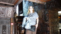
From there, we walked up Hill Street more to a side road, where we walked on to the grounds of Plas Newydd, a house that became famous from two ladies who lived there together for fifty years, from about 1780 to 1830. The two ladies (one of whom was a capital-L Lady) were ladies from Ireland who fled together to Wales. One woman was being pressured to go into a convent, and the other was attracting the eye of a married man in his fifties. The two women were friends and so decided to go live a retired life together with their maid, who helped them flee Ireland.
The women were seen as a bit eccentric, as they wore practical Irish clothing that was more masculine than normally seen in the area, but the locals seemed to enjoy them, especially as the ladies looked out for the village as best they could. The town has a popular hotel where horses were changed, and somehow word got around about the women, and so they ended up hosting many famous people including Sir Walter Scott and William Wordsworth (who wrote a poem specifically for the women). At some point, the ladies got obsessed with making their farmhouse appear to be Gothic, so they asked friends to send them anything that was of carved oak. It seems that carved oak was going out of style, so people sent the women pieces of furniture, carved chests, wall paneling, church décor, and so on. The women had it mounted on the front of the house, up the main staircase, and in other rooms. It is quite a visual display.

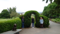
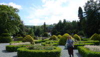
Outside the house, the grounds are lovely, with topiary out in the front and a woods walk down to a stream in back. We spent over an hour at the house and grounds.
Down Hill Street we went, across a bridge over the River Dee and up another street to look into canal boat cruises. They were over for the day, but when Mer asked, the woman gave us instructions on how to hike up to the castle ruins above town, which I was pleased to do. The woman’s directions boiled down to “keep going up.”

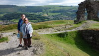
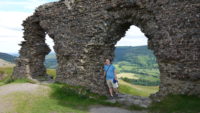
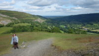
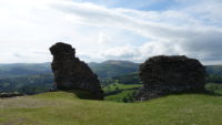
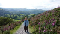
Up we went. There seems to be a theme of elevation going on in this town. It was about a mile and a half of up, counting switchbacks, but we took our time in the beautiful sunshine and stopped often to admire the unfolding views. When we did get to the top, we had a stunning panorama in any direction, as well as the castle ruins themselves.
The poor people who built the castle. It seems that it was only inhabited for about twenty years back in the 1200s. Then the Welsh burned it down so that the English wouldn’t capture it and use it. The ruins are very picturesque, though.

The views looked out over the Welsh mountains to the west, an escarpment of exposed rock to the north, more hills and a canal aqueduct to the east, and hills and the town to the south. We also had a fair amount of wind, but after the climb up, the cooling effect was welcome. We walked around the ruin for twenty or thirty minutes and then headed back down.
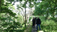
We checked in to our room and then got supper at a cafe on the river. By then it was 7:30, but there was still daylight plus sights unseen! So we went back up the far side of the Dee River, to the canal that is above the town, and we hiked the towpath back up the canal, 1.75 miles to the source where it splits from the Dee. There’s an artificial falls there shaped in a long arc that I think helps create a reservoir. It was a flat walk, but the river was pretty where we could see it near the end of the hike, and the canal was smooth and reflected the trees and bridges above it. It was a peaceful walk.
And so, after managing to cram thirteen miles of walking into a seven-hour touring day, we retired to our room. We’ll get to add more Wales to the Wales tour tomorrow.
Wales 2024 – Day 4, Thursday, Lincoln, England

Sometimes a place has so much history that if you have just one day to see it all, you can only dip your toe in the shallow end. Such was today, especially since most things in Lincoln close down at 5:00 even in the summer.

Dubbs met us at out hotel for breakfast, and then we drove out the couple of miles to the International Bomber Command Centre. The IBCC is a memorial to the bomber crews and support staff who were based in Lincoln County, which held twenty-seven airfields for bombers. The IBCC only opened in 2018, and so the museum and memorial make good use of modern design.

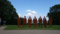
We joined a tour of the grounds, which took us to the front memorial commemorating Operation Manna, in which the British dropped thousands of tons of food to starving civilians in the Netherlands in the winter of 1944-45. We then wrapped around to the side of the building to see the peace gardens planted with plants from all the continents that served with the RAF (all six habitable continents and more than fifty countries). The guide took us to a lime tree grove where there was a tree planted in the relative location (compared to the other trees) of each air base in the county. I thought the trees were lime trees because of the nickname for the British (“limeys”), but the guide said they were hardy and didn’t grow so tall as to obscure the Spire, which is the main memorial to the air crews who died in service.

The Spire is a tall airfoil-shaped piece of steel that is as tall as the wingspan of a Lancaster bomber (102 feet tall). It’s on the top of a hill opposite of the Lincoln Cathedral, and is surrounded by steel plates with the names of all the men (and one woman) who died flying on a bomber cut out of the plates. There is also a sculpture of an air crew who died on the Dambuster mission in 1943 that is silhouetted against the sky and cathedral, which is very moving.

Meredith and I then headed in to the museum to a prestation room (Dubbs had to do something school-related). In the room, we played the part of members of aircrews as we were briefed on our mission on June 5th, 1944, for Operation Taxable (as part of the D-Day landings). We received precise navigation and meteorological reports, and got our orders to fly in circles over half the English Channel, dropping “window” – strips of aluminum which would scramble German radar. Because it made radar useless and the strips drifted toward Calais and away from Normandy, it made the Germans think something major was moving toward Calais. The presentation was fitting, as today was the eightieth anniversary of D-Day.

We met back up with Dubbs and Candice for the small but excellent museum. There is a small theater showing films about the bombers and crews, and a room-spanning placard series showing twenty-four hours in the life of a bomber crew. There were multiple places where you could listen to crew and ground crew tell stories, and several films of people in uniform telling you how they worked and fought. Since one of the missions of the IBCC is for reconciliation, I saw a young German fighter pilot tell how he shot down a Lancaster, which was still somewhat hard for me to hear. It’s an important reminder that the vast majority of Germans were doing a job they were forced to do.

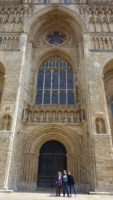
That wrapped up our quick overview of the IBCC. I could have spent more time there, but we needed to move on to Lincoln Cathedral. Candice had other commitments, so she left us there. Dubbs showed us a couple of tombs of some of her more royal relatives from way back, and we looked around the cathedral while waiting for a tour and trying to avoid the service for hundreds of school children in the main space. Meredith and I were very much amused at a stone placed in the floor that read something to the effect of “This stone is a temporary marker for so-and-so, died 1777.” I’m sure they are going to get the permanent marker in place any day now.

We met up with a tour guide at 2:00, and she took us outside so we could hear her since the school service had just ended. Some highlights from her tour:

– The cathedral was started just before 1100 and originally had a wooden roof that burned twice. When it was replaced with a stone roof, the walls collapsed forty years later “in an earthquake” from which no other buildings suffered.
– The rebuilt cathedral was going to be in one style, but ran out of money, so they kept the older facade.
– The inside and outside used to be very colorfully decorated, but the decorations were all destroyed by Cromwell and company.
– There was a “dole window” where poor pilgrims could knock and get enough money for a meal and lodging. Our guide intimated that this is the source of the expression “on the dole.”
– One of the large high-up stained glass windows is actually just full of old window shards reused in the new window. It’s quite pretty, and you can’t tell without binoculars that it’s reusing shards.

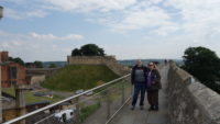
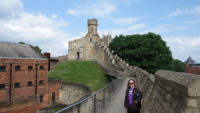
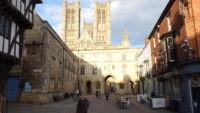
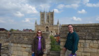
More touring! More history! Off we went to the Lincoln Castle, which still has intact walls. The inside of the walls contains a Victorian prison and a building that has been used as a judicial hall on and off over the centuries. But the walls are the real prize. You come up sixty-five steps to be greeted with a grand view of the cathedral. You are then allowed to circumnavigate the entire wall, including being able to go up the one existing tower. On a sunny day, it was pretty spectacular.

We went down to the vault area to see one of the three displayed copies of the Magna Carta (the others are one in the British Library and one in Salisbury Cathedral, both of which we have seen). We went down into the vault, and there it was! The last in our collect-them-all series! Boy, it sure looks to be in good shape! Why is the docent apologizing for the replica? It seems the real Magna Carta was taken away to an unknown secure location yesterday, so we missed it. We did get to see a good film on how the document came to be (near civil war with the king) and why it has been so important (the first document to limit a monarch with law).

That ended the history tour for the day, as it was almost 5:00. We got a very good supper in the old quarter, got a quick tour from Dubbs of parts of the Roman wall that still exist in a few places, and then went down Steep Hill (it’s really called that) to a pub for a pub quiz (trivia). We met up with another of Dubbs’ friends and classmates, a fun young woman from India, and we whiled away a pleasant hour or so playing trivia. We came in second of four teams.

And so we said goodnight, and Mer and I headed back up Steep Hill to go to our hotel. Sometimes you have to work surprisingly hard to get to the shallow-end stuff.

Wales 2024 – Day 3, Wednesday, Hadrian’s Wall and Lincoln, England

Travel takes a little bit of madness. You pay a fair chunk of money to be up for twenty-four hours to get to somewhere to disrupt sleep patterns, eat strange foods (or at least familiar foods prepared in strange ways), make your feet and other body parts hurt with exertion, encounter strange languages like Scottish and North Lancastrian, and generally put yourself out there into unknown situations. And a little madness sometimes leads to bizarre things, like letting Dubbs be in charge.

We were driving from Keswick to Lincoln, where Dubbs and Candice are working on their master’s degrees, which is a little over three hours away. But Dubbs wanted to see Hadrian’s Wall, which adds about eighty minutes to the trip. But a) we’re all nerds and like old things, and b) we knew we’d spend more than eighty minutes on the site. So off we went, getting to Housesteads Fort along part of the wall.

Dubbs picked that part of the wall because of the fort (the foundations and some of the walls of the fort are in excellent condition), but also because it has a small section of Hadrian’s Wall on which you can (legally) walk. And so we churned our way the half mile from the parking lot to the museum and fort, mostly uphill (it seems the Romans wanted to put a wall and fort at the top of a hill), with a temperature of fifty and in winds gusting over thirty miles per hour in spitting rain. I was pleased to be wearing every jacket I brought, for a total of four layers.

The fort remains varied from being roughly ground-level to being about four feet high, and there were information placards all over the site. We started by going around the entire outside of the fort, climbing to the top of the hill where the fort and Hadrian’s Wall met, and then we went down along the wall, through a gate, and back up the other side of the fort, all in varying degrees of rain. Once we got to the front of the fort and entered it, the rain ended, although the wind kept us company.

Dubbs called Rome “the original franchise” because the Romans standardized so many things. The Roman fort was based on one design, which was adapted for local topography. It had four gates, which had roads that led to the main administrative center of the fort. There was one large (and heated) house for the commander and barracks for the eight hundred men who manned the fort. The men slept eight to a room in cramped quarters. There were some buildings right outside the fort for tradespeople and some families of the soldiers. This particular fort was in use for over three hundred years (from about 100 to about 400).

We wandered all over the site learning these things, and Meredith asked the ticket taker where we could walk the wall. She indicated up the hill to where we had started our tour. I had seen the wall and wondered about it, but Dubbs had protested that the sign at the top of the hill indicated that the wall trail went down along the fort and not back along the wall. I imagine the sign makers from thirty years ago:

John: Hey, Bob. I finished the sign for the wall trail going this way. Should I put the other sign up for the wall walk?
Bob: Eh. It’s a wall, and you can walk on it. It seems pretty evident to me. Besides, the match is on the telly at the pub in twenty minutes, and it’s raining and windy. I say we leave it.

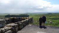
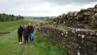
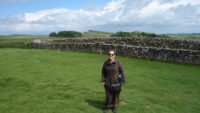
At any rate, we went back up the hill and walked the half mile or so of wall that could be hiked. The views were spectacular and the drop-off on the Scottish side was dizzying in places. We came back along the normal footpath next to the wall.

We explored the small museum, and then went back to the car park area and had lunch at the cafe. All told, we were on site for over three hours. It was a good time.

The three hours to Lincoln were uneventful, but the end was a bit tough – I had to drive through parts of the medieval town center, and that was stressful. We dropped Dubbs and Candice off at the university about a mile outside the center (or centre) and drove back to our hotel, where Mer and I got situated.

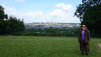
So it was we finally went out to wander the small town center about 7:30. We stumbled across some spectacular views of the cathedral and some of the original wall. We ate supper at a pub, and even found some Roman ruins of the eastern gate on the way back to the hotel. That was a good warmup for All Things Roman in Lincoln for tomorrow, because Dubbs is still in charge.

Wales 2024 – Day 2, Tuesday, the Lake District, England

“Next time” is a great touristic rallying cry for us in order to save our vacation sanity. When we can’t see everything we wanted to see, or when things don’t go as planned, we often console ourselves by saying, “Next time!” Sometimes “next time” can happen because of rearranging plans, and sometimes “next time” comes much sooner than you would think.

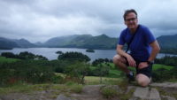
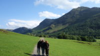
Yesterday evening I had hoped to hike out to Friar’s Crag, which we did. I had also hoped to hike up to a viewpoint in Castlehead Wood, but the sign said it took forty minutes, and it was late, so I regretfully skipped it and told myself I’d do it next time. Enter jet lag. I was wide awake by 5:00 am, and since we are so far north, it was already light out. I saw that it wasn’t raining, and so I dressed quietly and slipped out around 5:30 to see if I could manage the hike up the hill. The walk took me through town and down to the lake, and I met no one (in fact, I met no one until I got back to town on the way back to the B and B). I loved that. I got to the trailhead for Castlehead Wood and took it next to pastures to where it crossed a road. The directional signs for the trail disappeared, and so I made my trail decisions based on what went up. And up it went. There were two tough sections – one long and steep section and one short section that required a little scrambling over rocks.

It was worth it. The viewpoint had a magnificent view of the lake and the hills overlooking the lake. There were good views over the hills away from the lake as well. There was a bench there, so I sat for several minutes and watched rain showers move in over the southern part of the lake. I decided that that was a signal for me to get going, and I got back to just past the boat launch before the rain caught me, so my last half mile or so was in a light rain. My total time to hike to the hilltop and back was one hour, which included sitting at the top for a bit. I was back in time to shower and still take a forty-minute nap while Mer went out and hiked in a park nearby. Then we had breakfast and headed out for the day.

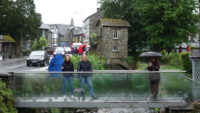
The forecast called for showers and rain all morning until between 1:00 and 2:00, so Mer tweaked her plans for the day, putting the indoor stuff first. We all (Mer and Dubbs and Candice and I) piled in the small car and headed south for half an hour, to the town of Ambleside. Dubbs had wanted to see Bridge House, a house built on a bridge, and a picturesque one that was sketched often in the 1800s and is now photographed often. We were having trouble finding it, but we drove past a small bridge while looking for parking. Dubbs said out loud, “That can’t be it,” because of the small size. It was, of course. Still a pretty picture to take, but more amusing after Dubbs’ evaluation.

From Ambleside, we drove north again to Dove Cottage and the Wordsworth Museum. Wordsworth, along with his friend Coleridge, invented a new plain style of poetry that celebrated nature and ordinary people, and so gave birth to Romantic poetry (“Romantic” as in the literary period, not the hitting-on-a-girl kind). Wordsworth inherited some money, and so he and his sister were able to move into Dove Cottage here in the Lake District, where they went on walks (at a time when people didn’t walk in nature for pleasure) and where Wordsworth wrote poetry and his sister kept a journal. She also transcribed Wordsworth’s poetry for him, which is fortunate, since his handwriting was poor.

The museum is small, with four rooms highlighting Wordsworth’s poetry and life at Dove Cottage. The cottage itself is furnished much as it would have been back in the early 1800s, according to things mentioned in the Wordsworths’ letters and in Dorothy’s journal. We were allowed to explore the cottage on our own, including being able to touch anything. The admission also allows for touring the grounds, but when we tried to do so, it started raining quite hard. So we gave up on the grounds and drove back to Keswick to get a light lunch before heading out again.

That worked well, as the rain stopped as we were looking for a place to eat, and by the time we were on the road again, the sun was burning through some of the clouds. We headed off west and south to do a Rick Steves’ guidebook’s recommended driving tour.

That was a (mostly) great choice. The sights of driving through the Lake District mountains were spectacular, but the roads were terrible, with a narrow way and bad sightlines. I drove slowly and cautiously, but the driving was tense in a few places. But the results were worth it.

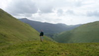
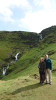
We drove up and up and up to Newlands Pass, where there was a small parking lot. We got out to hike a few hundred yards in a stiff wind over to a waterfall, which was lovely, We then crossed the road and climbed part way up a mountain. I got to a ridge area first and was hit with a very strong and steady wind. It is probably in the top two strongest winds I have ever encountered, only (maybe) bested by the winds at the top of the Saxholl Crater we climbed in Iceland. It was a giddy feeling to experience that much power in the wind. The views from the ledge area (about half-way up the hill) were grand in all directions.

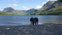
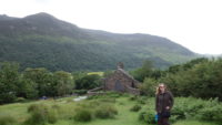
We drove on (down) to the tiny village of Buttermere, which has a cute and scenically situated church, and a convenient cafe. We visited both. From the cafe, we hiked down to Buttermere Lake, another pretty setting of water and hills.

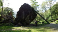
We then headed back up and up through the Honister Pass, which tops out at a functional slate mine, which was closed by the time we got there. From the pass, we drove back down into the Borrowdale Valley. We stopped to hike to the Bowder Stone, which is an enormous chunk of rock that probably fell from a nearby mountain, but is now freestanding. It’s big enough to have a stairway built on to it so you can climb up to the top. We did.

The last stop of the evening was at the very swanky Lodore Falls Hotel, where Candice and I ordered hot chocolate to ensure we got the required exit code for the parking lot. It was a very nice place to sit and relax, but then we hiked ten minutes or so behind the hotel to the eponymous Lodore Falls. The Falls are tall and narrow and pretty. They are surrounded by forest, so we couldn’t see all the way to the top.

That ended the scenic drive, as I drove past an optional turnoff to a few other sights. With the lakes and mountains and rock walls, it is difficult and dangerous to turn around, and it was already 8:00 pm, so I kept going on the road the short distance back to Keswick.

And so ended a long but touristicly successful day. An early start and some strategic scheduling minimized today’s “next time” category.

Wales 2024 – Days 0 and 1, Sunday and Monday, Keswick, England

Getting launched is an important aspect to any travel itinerary. Every year I give Meredith a guidebook for Christmas which lets her know which European country I picked for us to go to that summer. This last Christmas, I gave her a book on Poland, and we were excited by that prospect. Then the price tag hit – Poland’s airfare stubbornly stayed up around $1,000 each, over several weeks, even five months out. When I stumbled across tickets to Scotland for $470 each, we made the reluctant choice to change our destination. While Meredith has her own rule that we can’t repeat a summer-trip country, and we had been to Scotland in 2017, we decided to use Glasgow as a launching point to go to Wales, which is new to us.

But, Wales is a haul from Glasgow – five hours away or so. That’s a long trek on no sleep, so we decided to throw in the northern Lake District town of Keswick, England, into the tour. It’s only a two-hour drive from the airport, and we had never been to the Lake District before. As a bonus, our friend Dubbs, who is studying for yet another master’s degree over in England, agreed to meet us in Keswick, bringing along a fellow student and friend, Candice. So we are all here in Keswick until Wednesday morning, when we all go to see Dubbs’ university town, Lincoln, for two days. Then we finally head to Wales for ten days.

The Cuyahoga Falls to Toronto airport to Glasgow airport to Keswick was largely uneventful, although there was an hour delay for the plane to take off due to some paperwork not being filed. That got us to our B and B around 11:00 local time after our having been up for about twenty-two hours. Wonderfully, our room was ready, and so we went to bed for three or so hours. After showering, we were ready to head out with Dubbs and Candice about 4:00. Any touring on an arrival day is bonus, and so we got launched on our touring by going to the local lake boat launch.

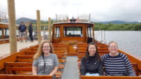
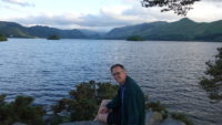
There is a boat service that pops around Lake Derwentwater, stopping at several points to drop off or pick up people. I expect it is used by hikers often, but it is also an easy way to see the lake and the surrounding hills. I think our boat was the penultimate one of the evening, and with the overcast skies and some luck, we ended up being the only people on the boat for the first half of the run (we picked up a small group of people half-way around). Mer and I are fond of what we have coined “butt-sitting tourism,” especially on a long travel day. The boat tour lasted about fifty minutes, and we did have some misting rain at times, but it was still a very pretty cruise.

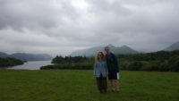
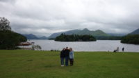
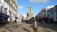
After that, we wandered in a park next to the boat launch before heading to supper at a local tavern in the pedestrian area of town. That was a welcome stop, and then we swung by the B and B to reorganize. Meanwhile, the sun mostly came out, so when we went back down to the lake to hike out to Friar’s Crag, it was very picturesque. Friar’s Crag is at the end of the main walk that goes past the boat launch, and it looks south over the lake and hills. While the sun was shining on us, there were clouds on a few of the hills, and the clouds spilled down the slopes into the valley, giving a dreamy look to some of the edges of the lake. We lingered there for a bit, and then walked back to the B and B. Dubbs and Candice went to a store to get some ice cream, but Mer and I went back to the room in the hopes of getting launched on a good night’s sleep.