Monthly Archives: July 2017

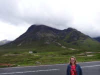
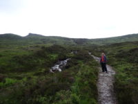
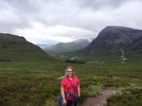
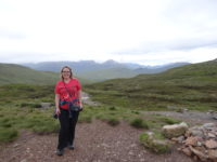
Scotland 2017 – Day 14 – Saturday – Glasgow

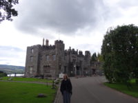
There is always a certain amount of relief when I get to drop off a rental car, especially when the car company employee says everything is okay, and especially when I’d refused insurance coverage thinking my credit card covers it (I checked today, and it does, but I was nervous about it). So today we turned the car in at the Glasgow Airport, and became dependent on public transportation and feet again. Not a bad thing in Glasgow – the streets are not anywhere I would want to drive, thank you.

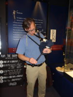
We got a bus to the central bus station and walked the five minutes or so to where we were staying the night – the Pipers’ Tryst Hotel, which is attached to the National Piping Centre. It was a little before noon and the room was not ready, but they told us it would be in fifteen or twenty minutes, and that we had free admission to the bagpipe museum in the building. Naturally, we did that. It is really small, but well done, especially if you like the pipes. Meredith and I got a couple weak and sick bleeps out of a practice chanter (the melody part with no bag attached), and I got the drones going on a full set of pipes, but not the melody chanter – it would not sound at all; maybe it was broken or there was a valve I was missing. Still, good photo op.
We checked into our room and set off, stopping at the Glasgow Art School cafe for lunch, where Meredith reminded me of her dominance in ping pong, 10-3. After lunch, we walked over to the Tenement House Museum, which is very interesting and unusual. Tenement, in this case, refers to a style of shared building, and did not mean it had to be a slum. This house seemed to be fairly middle class, with four rooms. What was unusual in this case is that the woman who lived in the tenement home lived there for over fifty years, and she changed almost nothing in the rooms and kept many of her documents and such – so much so that when the flat was opened up after she died, which was after a ten-year stay in the hospital, they found canned jams in the cupboard, some dating from 1929. Somehow, a woman saw through the dust and mildew of ten years of the place’s being empty, and she bought the place, cataloged everything, and then sold it to the Scottish National Trust as an example of early twentieth century life in Glasgow. The place was so untouched that they only had to put gas lighting back in to replace the electric lights installed in 1960. It was an interesting museum based around a very normal working woman and her home.
We got all-day passes for the subway, which is in a ring around Glasgow, and it is a bit cramped – I hit my head while standing in the car. But it got us near the Kelvingrove Museum, which is Glasgow’s eclectic museum. It has a Spitfire airplane from WW 2, dinosaur bones, various taxidermy animals, ancient Egyptian items, sculpture, paintings, and lots of Scottish art and history. Their art museum has a number of individual works by great impressionists, and I was impressed. Their most famous piece is Dali’s Christ of St. John of the Cross. It is a fantastic work, but there was public outcry at the 8,200 pounds spent on it in 1952. It is now estimated to be worth 60 million pounds, and put the Kelvingrove on the international map. I had not known it was attacked by a man in 1961, which resulted in much of the bottom section’s being torn. I actually could not tell – the restoration went very well.

There was also a comic art collection special exhibit going on, but sadly, by the time we went to check it out, we realized that it cost seven pounds each, and we only had about forty-five minutes until the museum closed. Next time.
After supper, we finished our Glasgow evening with a thirty-minute walk back to the hotel. We like walking in cities so that we can see them at a slower pace. We detoured through a pedestrian area just to see people out and about. The weather was perfect, and people were just milling around, shopping and eating and hanging out.

That wraps up Scotland for this trip. Our flight is at 8:30 am tomorrow, so the only sights we will see will be the bus stop and airport. The trip was a wild success, with only a few bumps along the way and with mostly good weather (once we figured out to carry up to three layers of clothes with us). My goal of not being too hot was met, and it was nice to be in a country where I could speak to the locals, mostly. Glasgow has a bit of an accent.
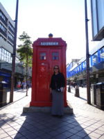
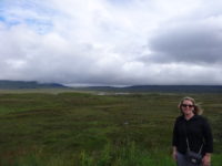
 

Here is to future travels! Let’s see where we go….

Scotland 2017 – Day 13 – Friday – Balloch, Loch Lomond

She burst into tears suddenly, fleeing out the door onto the moor, her blond hair wildly blowing in the wind. Her egress was noted by the ominous figure watching from the window above. He moved suddenly, motivated by concern: what if the cats got out? He pursued the retreating figure, his dark form standing out starkly against the fading light.

She fled, her heart torn in two – the man following her was the cause and cure of her pain. She longed both to embrace him and to slap him, the beginning and ending of every bitter thought.

“Waaaaaaaa!” she cried suddenly as she tripped and fell into the fell foul fen. As she struggled to free herself, he appeared, silhouetted against the failing sun. He reached down to her, throwing his arms about her, and lifted….and dropped her a moment later as his back went out.

Meredith has been delighted to see little bits of moor over the last few days, since so much English literature takes place on moors. Despite my protests that nothing good ever happens on a moor in a book, she still said she was able to see herself as a heroine in one of the works she teaches since she could now visualize the moor. As we left the Glencoe area, we drove through amazing mountainous territory, emerging onto a huge moor on the other side. Thus was born the above narrative as I tried to work out what our novel would look like.

We drove on for an hour and forty minutes, arriving on the southern tip of Loch Lomond in the town of Balloch. Why Balloch? First and foremost, they had a room at a good B and B in town. But I also wanted to be close to Glasgow (thirty minutes away) so the car return tomorrow could be easier, and I wanted to see Loch Lomond because of the song that mentions it (the high-road/low-road one). Those seemed good enough reasons to me, despite the fact that Mer’s guidebook said there was nothing much to see here.

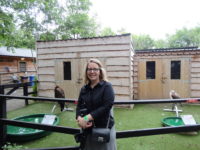
Ha! We saw a lot of the town! Multiple times! Because the map I was given was stylized without street names. And house numbers are rare in town – most houses are named instead. So it took several tries and a long, roundabout way to make it to our first stop, the Loch Lomond Bird of Prey Centre. To be honest, I thought we might get to see hawks and falcons in flight, but not in this case. There were about thirty birds of prey, but they were all tethered to the ground by a long lead on the leg. They seemed fine with that, and it allowed us to see them up close, which was really cool. They had many different types of owls, which was very cool; owls are fun to watch. They also had some hawks, and falcons, and buzzards (not vultures!), and one gorgeous golden eagle. She was beautiful. We got to listen to the owner/trainer chat about the birds some, and it was clear he loved the birds.

By then, we were hungry, so we went looking for a cafe we had been told was near the base of the hill that held the castle. Once again, the map did not come to our aid. So, after wandering for thirty minutes, we gave up and went into a regular restaurant for a very late lunch. After a quick trip back to the B and B to check on some things, we decided to go find the castle itself, which is in the middle of a huge and well-kept park. The castle is small, but tidy, and it overlooks the loch and has extensive grounds, and great benches for sitting. So, while we were sitting at a castle overlooking Loch Lomond, a bagpiper came along and started playing, just for the heck of it (not busking). How is that for a bonnie Scottish moment?

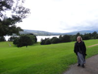
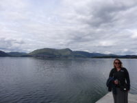
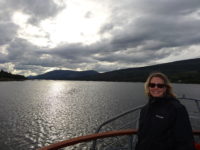
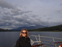
We strolled back down the hill and along the loch, and checked out the boat cruise schedule. We had just made it for the 7:00 “sunset” cruise, which lasted a little over an hour. It seemed a mellow way to get to see the loch, so off we went. There was occasional narration from some famous historian, but the narration ran more or less along the lines of “people with too much money built huge homes here in the 1700s and 1800s” followed by “people with too much money now play golf here.” Still, seeing the mountains over the loch was worthwhile, and we outlasted everyone on deck as they fled the cold and wind, so we had he deck to ourselves for the return trip.
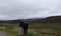
We got supper at a restaurant that our hostess had recommended, and it was a cozy spot, except for the MacMontezuma that hit me just after I ordered. Sadly, Mer ate most of her meal alone.

That wraps up my turn of being in charge. Meredith has Saturday in Glasgow, and then we fly home really early on Sunday morning. Lord willing, we will be home by supper on Sunday, but first we have Glasgow to explore.

Scotland 2017 – Day 12 – Thursday – Cruachan and Glencoe

The musical Brigadoon is about a Scottish island that appears out of the mist once every hundred years. Gazing out the window this morning, Mer commented on how she could see why Brigadoon was set in Scotland.

When we woke up, we could not see across the loch because of mist and fog, but by the time we went down for breakfast, we could see a little ways up the mountains on the other side. By the time we were finished with breakfast, they were fogbound again, and settled into a fog ceiling about fifty feet off the water. My plans of going hiking today clearly (foggily?) had to be changed.

Our hotel had a binder in our room that included things to do in the area. One item caught my eye – “The Hollow Mountain” – a hydro-electric station built one kilometer into a mountain. I think Mom had told me about it, or one like it, so away we went. It was about an hour away, and the fog lifted quite a bit, so that by the time we got to the station, Cruachan, you could make out most of the low-lying mountains, and an on-and-off rain was falling. Not that that matters much underground.
Cruachan was the first pump-and-generate station in the world, finished in 1965. They can bring power online in less than two minutes to meet high demand times. The do that by using water stored in an upper loch that falls down into the mountain to run turbines, and then empties into the lower loch. The station can operate for up to fourteen hours straight if needed. Then, when the demand for power goes down (like after midnight), the station buys cheap excess power to pump the water back up to the upper lock to be used at next peak demand times. For comparison, it takes up to eight hours to bring oil or coal plants online, whereas if the Cruachan technicians think demand may be coming, they can pre-spin the turbines and have additional power online in forty seconds. Nifty.

Our tour took us into the mountain on a bus, while a cute-accented Scottish woman talked all nerdy to me. I need a moment. We got to look into the main chamber where the top of the spin-up generators are for pumping the water back up; the actual turbines are below those, thirty feet below where we could see. The space was enormous, and took fifteen hundred men at a time five years to excavate it, all by compressed air and dynamite, in twelve-hour shifts. For the noise, dirt, hard labor, and dangerous environment, they were paid about twenty times the average wage, but still, most men quit after eighteen months.
We grabbed lunch at the cafe, and so we spent over two hours at the plant – thirty minutes for the tour, and the rest in looking at the small museum and then lunch. When we came out, the fog had lifted, but there was a steady heavy mist/light rain falling. We headed back to the hotel, and as we got close, the rain stopped. It looked as if my hike might be back on! Because of my last-minute booking, the hotel was able to accommodate me for two nights, so we had to move rooms. The new room has sliding-glass doors looking out over the loch, so the room with a view got even better.

On to the hike! Because the fog had been moving in and out, I decided on a hike called “The Study” which was an easy hike along the valley floor near Glencoe. It was supposed to have great views of the valley, and if the fog was obscuring the mountains, then we would have a nice walk. It was past the Signal Rock walk from yesterday, on the same road, so we drove on. And on. And on. I was looking for signs, and finally I pulled into a pull-off and saw a sign. “The Devil’s Staircase.” This was actually my first choice for a hike, but it was labeled as “strenuous” in the guidebook and topped out at eighteen hundred feet, which would be a drag if the top was in a cloud. But sometimes fate hands you a different hike, and who was I to question that, especially in a country where turning the car around can take three miles?

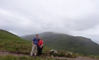
The fog and rain were still holding off when we started the hike. At first, the path was wearisomely muddy; it would be unpleasant to trudge up in mud for an hour. But the mud was replaced with gravel in only a few hundred yards, so we were in business. The path wound uphill next to a mountain stream, and that was pleasant. The incline was noticeable, but not bad. For the first two thirds of the path. Then it got steeper. But the path wound back and forth, and we took frequent breaks to look around, so it was manageable. We had the path mostly to ourselves – there were two other groups behind us, but the relative solitude made each turn feel like a discovery. The mist swirled around the upper reaches of the surrounding mountains, which made it feel a little magical. We laughed when we saw a small slate sign proclaiming “Shop – 1500 m.” I wasn’t not sure why someone would haul that up the hill for a joke, but they did. And then we saw a sign again at 500 m. and again at 200m. And then there were two tents set up with an honor-system store of various snacks, each one pound apiece, with a tupperware container for the money. Honest folks, these hikers.

The views from the top were grand. We could see a new ridge of hills, and the path continued on for several miles to the next town. Since our car was behind us, we were turning around, but we lingered at the top for a bit, until it began to look as if the rain was coming. We walked down, walking in and out of variously light and hard mist, so that by the time we got to the car, we both looked as if we were covered in dew. For a day that had started out with scrambling for new plans, the hike was a huge success.

We went home to our swanky room, and did something we have never done – ordered room service. It was just too good a view to give up. After supper, Mer flicked on the TV and we got hooked on a show about Welsh and Scottish castles under King Edward I of England around 1300. The nerd runs deep in these two. Mer then got caught up in watching Men in Black, so I wandered to the lounge to type up Ye Olde Bloge. A day of healthy mind and healthy body.

Scotland 2017 – Day 11 – Wednesday – Kentallen, Glencoe, Fort William

Skye set our new northerly position record – Skye sits at the same longitude as the southern Alaskan peninsula. We turned south today, heading to the Glencoe area, which also constituted our trip’s longest drive to accommodations, taking about four hours to get here. My brother Shannon had insisted we go to Glencoe, so we did. Of course, since I do these things on whims and last minute, the only hotel I could find was about $150 a night.

That turned out to be an okay thing, as we finally pulled in to the hotel in the afternoon, and it was sitting right on a seawater loch, Loch Linnhe, in the small town of Kentallen. Our room looks right out over the water to mountains all around. Not bad. In fact, after just an hour or so here, I booked us a second night, realizing that we would not fit in everything I wanted to see and do. Looks as if Shannon made a decent recommendation.

After lunch and our getting situated, it was about 4:00 when we finally got going on seeing the sites. That is late, of course, but Scotland is helpful with daylight until 10:00 or later, so we made good use of the time. We drove over to nearby Glencoe, which is dramatically surrounded by mountains. This greater area actually has Britain’s highest mountain, Ben Nevis, at 4,400 feet; there are plenty of hills around.

We drove past the town to a parking area where there was a short hike I wanted to do, Signal Rock and An Tor. Mer’s guidebook had it marked as scenic, and it was right at the foot of the Three Sisters mountains, as well as another one. I figured Signal Rock would have great views, so I consulted the handy map in the parking lot, which showed three hikes, and set off on the black trail, which Meredith pointed out that her book said was strenuous. Phah! It led to Signal Rock! Up we go!

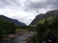
The trail started off well, crossing a bridge over a beautiful river that ran through a gorge with the mountains just beyond. It climbed up into a dense woodland area, and eventually the black trail split off from the lesser and unimportant blue and yellow trails. Of course, as befits the dignity and importance of the black trail, the trail went from a wide gravel trail to a deer path climbing steeply uphill, promising grand views. We did get them, actually – all along the trail we had the mountains looming over us, and it was not hard to take a breather after each steep section, pausing to look around.

Finally, after a fair amount of up, I saw a small side trail that led to a rock. This MUST be Signal Rock! I happily strode up to it! All eight feet of it. Densely surrounded by trees. Huh. Maybe this was just a false Signal Rock. The real one must be further along the trail. Off we go! We did come to an opening in the forest that gave almost full views of the Three Sisters, so that was a rest stop for us. The trail went down for awhile before climbing again, which was promising, before falling again, which was not. Eventually we rejoined the blue trail, and I saw a sign for Signal Rock, pointing back the way we’d come. The underwhelming rock must have been it, but at least the hike was great. We got back to the parking lot, and I looked at the map to see where we had gone. And there it was – Signal Rock. On the blue trail.

Off we went again, across the bridge, up the hill, spurning the black trail and staying on the wonderful blue trail. This was easier going, and it also started going up. Great sign! We went on for about fifteen minutes, and started hearing German-speaking voices ahead. Great sign! Tourists! We walked up to an information placard and a huge rock – the placard explained this was indeed Signal Rock, and we could climb it using the stairs at the back! The Germans were already on the rock! Yes!

The rock was indeed huge, and the stone stairway was cool, and we made it to the top. To see six Germans and their dog, and lots and lots of trees. Surrounding Signal Rock. The Germans said hello and made their way down. After a minute or so of being swarmed by midges in the (first-time) breeze-free area, we followed them, and walked back to the parking lot. During this return walk, I noticed that for the first time of my being in Scotland, I was sweating. A first! The walk was still pretty, and at least we found Signal Rock.

We headed north to the tourist mecca of Fort William, the second-biggest town of the Highlands, with about ten thousand people. We happily found parking and made our way to the Crannog Pier, where there was a seafood restaurant and a place for boat tours. I wanted to catch the 7:30 evening tour, which is accurately not a sunset tour since the sunset is so late. But the evening sun is very pretty here, and it promised to give us great views of Ben Nevis, which towered over the back of the town. There was even a chance that we would see seals, otters, or porpoises.

We got on board and headed out on a ninety-minute cruise. Having been sweating less than two hours before, I was now wearing four layers of shirts and jackets. That did the trick. The captain announced we were making a beeline for the right side of the loch further down. It turned out that the cruise offered a good view of the Jacobite Steam Train, which is sometimes known as the Hogwarts Express, having filled that role in the Harry Potter movies. Since Meredith teaches tons of Potter-crazed fans, this was an exciting prospect, if we could make it in time.

The scenery kept changing delightfully, with the loch all around, and different mountains coming into view, including Ben Nevis as we looked behind. We passed a campground on the right, and we waved at the family strolling the beach. We got past the campground to the train tracks, and we waited for a couple of minutes before we saw steam plumes in the distance. We had made it, and we got our picture of the Hogwarts Express.

The rest of the cruise was pleasant, with calm seas. We never did see any wildlife other than sea birds, but the surrounding views made up for that. As we returned to Fort William, Ben Nevis dominated the skyline, but some bare-rock peaks, shining in the evening sun, came into view as well. We also got to see a sea loch that marked the entrance to the Caledonian Canal that crosses central Scotland.

We got off the boat and grabbed supper on the main shopping street before getting back to the car and heading back to Kentallen. Meredith got a delightful surprise – she teaches The Great Gatsby, and in the book, a major symbol is a green light at the end of a dock. From our room, there was a visible green light across the bay. It was on a buoy, but to Meredith it was Daisy’s dock and she was happy to have found it. In Scotland.

[The internet here is verrrryyyyy slow, so more pictures later.]

Scotland 2017 – Day 10 – Tuesday – Isle of Skye

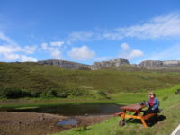
I decided to continue the guidebook-recommended northern loop of the Trotternish Peninsula, since our hostess also recommended it. Much of the initial driving was on a single-lane road, but there were plenty of pull-offs, so that was never an issue. I think I got out less than five miles before we pulled off to look around at the mountains. It was also very quiet. Apart from the bleats of the sheep in front of us and the very occasional car going by, there was nothing to hear. It was very peaceful, and we stayed there for about ten minutes, watching sheep and enjoying the sunshine.

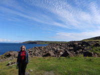
We continued around the drive, stopping once more by the ocean where a cliff towered over the road. Again, it was quiet, and we stayed for five or ten minutes, before heading over to the Skye Museum of Island Life, a little museum of seven thatched cottages depicting how people of Skye lived in the late 1800s and early 1900s. Again, as we have seen several times on this trip, life was hard and not all that different from over one thousand years ago.

The museum had one “big” house where the parents and ten children lived in three rooms. This house was actively lived in until 1954. There was a small barn, used to keep the milk cow warm during the winter, a weaver’s hut, a blacksmith’s hut, a social/music house, a general store, and a couple of other buildings. Many of the houses had lots of information about the people of island, including religion, farming, fishing, and such. Fishermen were very superstitious people, thinking it bad luck to see a woman, a minister, or a redheaded person before going out to fish. The farming (“crofting”) was incredibly hard work where the ground was often too rugged to be worked by horses, and where it could be worked by horses, the tenants usually could not afford a horse. Meredith’s summary of the exhibit was, “We are soft.” That is about right. Oh, and Mer’s Scottish roots showed up in an older picture of a woman weaving a basket: the woman looked exactly like Mer’s mom did when she was young. It was eerie.

Up behind the museum was a cemetery, and we like touring cemeteries in beautiful places, and this one had a famous monument in it – to Flora MacDonald, who helped Bonnie Price Charlie escape from the government after his defeat at Culloden. Her grave is marked by a huge Celtic cross, which was interesting, but there were lots of other graves too, of course. One interesting feature was that many of the gravestones mentioned first-person perspective – “my mother” or “our parents” – and the stone usually mentioned who put it up in addition to whom it memorialized.

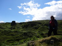
Next stop was the Fairy Glen near Sheadar, which was wonderfully bizarre. Mer had wondered if we would know when we got to the Glen. It was pretty obvious. One minute we were in beautiful Skye countryside, and the next we were in a world where you could see the possibility of fairies living here. There were dozens of conical mounds, traversed by sheep paths, which gave each “hill” a terraced effect. We got out and hiked over several of the fairy towers; we had never seen anything quite like them before. We passed on attempting to climb the largest one, the top of which looked to be very difficult to reach. We had a good time, but did not see any fairies.

That ended the scenic loop, but on the recommendation of our hostess, we drove over to Dunvegan, to Dunvegan Castle, which has been continuously lived in for over eight hundred years. We got a very late (3:00) lunch at the cafe, and then we wandered the gardens. I was car-weary, and a little tired of touring buildings, so a quiet walk in pretty gardens was perfect. We spent about an hour in the various sections of the grounds. The castle is well situated on the sea with hills and mountains about.

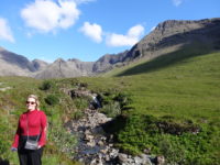
I decided we had time to drive to the southern part of the island, to the beginning of the Cuillin Hills, which are pretty much mountains. They are difficult to hike and can be dangerous, since they are steep and remote, but there is one hike that is easy and fairly safe, and stayed with our earlier theme – we hiked the thirty-minute Fairy Pool Trail. That walks you right up to the Cuillin Hills, and does so on mostly flat ground. You also get to walk next to a small river that has several waterfalls and pools. We hiked up to near the top of the pools, and we just sat there for about half an hour. I dipped my foot in the water, and it was not so cold as I’d expected – by no means bath water, but it did not make my foot hurt. The sound of the water was soothing, and the looming hills were very impressive. This is probably my favorite spot in Scotland to date.

We walked back to the car and drove the thirty minutes to Portree, where we got supper. We also got take-out dessert to eat on a bench back at the B and B, looking out to sea with the mountains to our left and the Outer Hebrides on the horizon. This is the kind of day that can spoil you.

Scotland 2017 – Day 9 – Monday – Isle of Skye

Meredith and I grabbed breakfast back at the SoCoCo cafe again; it was cheaper than eating at the pub, and it was a good and scenic walk. Plus, I knew the day was going to be car-heavy, so I did not mind the extra walking. After breakfast, we walked back to the pub and checked out and headed westward, with our destination being the large Hebridean island of the Isle of Skye.

We got to drive along about twenty miles or so of Loch Ness. The loch is very pretty, but we did not see any monsters, and we must have avoided the most touristy towns, because we only saw one advertisement for a museum about the creature. The roads were fairly busy, though, so I can only assume the tourist trade is well.

During the drive westward, the landscape got more and more dramatic. There were more and more mountains, but these were different from the ones we saw in the center of Scotland. The western mountains were either green or rocky – there did not seem to be the patchwork pattern of heather we had seen earlier.

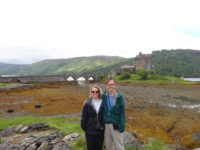
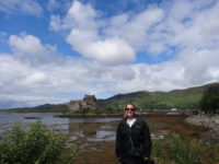
Close to Skye is a very pretty castle called Eilean Donan on a loch that is surrounded by hills. It is one of the most photographed castles in Scotland because of the landscape. The current castle itself only dates from the early twentieth century. It still seemed worth a stop. It seems we were not the only ones to think so, since approximately ninety-seven percent of Scotland’s tourists were there. There were four tour buses, and the three parking lots for cars were almost full – I felt lucky to find a spot, and this was at noon on a Monday. Yikes.

It was very pretty, and we wandered around the shore near the castle for about twenty minutes, with the strains of a bagpipe playing in the background (a bagpiper in full traditional kilt, but with a nose ring, which made us smile). It was a beautiful day, and it was good to get out of the car, but I decided against paying for access to the castle because of the crowds, and so we could get to Skye more quickly.

From the castle, it was a short drive over a very cool bridge out to Skye. Once on the island, my goal was to get lunch in Portree, the island’s biggest town (with about 2,500 people), which was still about forty-five minutes away – it is a big island. It seems as if the three percent of the tourist population not at the castle was chilling out in Portree. Again, parking was an issue, but we found a spot in a large lot right by the harbor. We had lunch in a nice cafe, and then we walked to the end of town, and up the town’s largest hill, where there is a park at the top. The views were spectacular, so we sat on a bench and ate the dessert we had brought with us. There seemed to be several small sailboats out near the harbor, so we watched them for about half an hour. We think it was a group learning to sail, as there was a small motorboat patrolling among the sailboats, and they all put in at roughly the same time at the same building in the harbor. Near to the park is a small tower that is open, and we climbed it, which gave us excellent views of the harbor, but I think the bench view in the park was the better place to see things.

Our B and B was in Staffin, a small village north of Portree. Mer’s guidebook recommended a drive along the route we had to take, so we were happy to make several stops along the short drive. The landscape north of Portree is beautiful. You can usually see the sea, and there are mountains and lochs, and not many buildings – it feels very remote.
Our first stop was at the Old Man of Storr, a rock formation that is very dramatic. There is a huge column of rock that fell off a larger cliff and embedded itself in the ground. You can walk up to it, but the path is very steep, so going is slow and we had to be at our B and B about 5:00. My compromise was to go about halfway, to a ridge where we could clearly see the cliffs. The bonus was we also could see around us toward the sea, with rolling hills, a loch, and mainland mountains all visible. It was hard to know where to look.

The next stop was at the Lealt Gorge, which is a gorge carved out where a river empties into the sea. Since I am afraid of heights, I did not spend too much time on the path near the gorge, but we walked along the path to the end, and it was a pleasant place to stroll. The path ended above the sea, looking down on a small factory that had processed clay for industrial use until 1960. The only way to ship the product was by, um, ship, since there was not road. People hauled the chalky clay three miles overland to the factory to dry it. Again, I am grateful my heaviest lifting is typically my lunch.

We checked in to our B and B in Staffin, and we love it. Meredith described our hostess as “our Scottish aunt,” and the view from our two windows is toward the sea and toward the nearby mountains. It is probably the most scenically placed B and B in which we have ever stayed. We grabbed supper in the village’s community center (one of only two places to eat in Staffin), and the food was excellent.

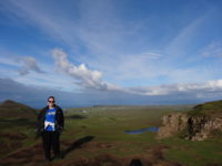
Based on both our guidebook and our hostess’ recommendation, we drove up the narrow road to the nearby Quiraing mountain pass. We had to negotiate several sheep in the roads, and we met two cars which required pulling off, but it was a pretty drive, and the views from the top were amazing. It was another place where it was hard to know where to look. We could have walked up more, but the path was on a cliff side, so I was leery of that. Plus, the winds were very strong and cold – I was in short sleeves in the village, but was up to three layers up on the mountain, and was still worried I would get cold. The wind comes a’ sweepin’ ‘cross the mountains.

That ended the evening. We drove back to the B and B, where our hostess made me a hot chocolate and gave us muffins while we sat in the sitting room. We have another full day tomorrow to explore the island, and the weather looks to be good again.

Scotland 2017 – Day 8 – Sunday – Inverness

I have found it wise to make a mellow day about halfway through our two-week vacations. It helps to recharge me for the second week. What better day to do that than a Sunday, a traditional day of rest? So that is what we did – had a (fairly) mellow Sunday.

We slept in, and then went to church. We both like going to churches in Europe when we can find an English-speaking service, so that was not an issue in Scotland. I poked around on the internet a few days ago, and found the Free Scotland Church, an evangelical branch of Presbyterianism. It seemed as if we should visit a Presbyterian church while in Scotland.

The service was very good. The church was a very pretty stone church with lots of dark woodwork inside. The service itself had three main parts – a cappella psalms (which were very tricky for those of us who did not know the tunes), a children’s story, and a sermon. The sermon was on Revelation 19, and had four main points: celebration (wonder for Jesus), preparation (working while waiting for Jesus), invitation (wedding with Jesus), and ultimatum (Jesus as warrior). It was well laid out. The people were very friendly, which has been my experience with the Scots in general.

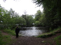
After church, we went walking along the River Ness, to the Ness Islands. The people of Inverness have paved paths and built bridges out to the mid-river islands, and it is a pretty and pleasant walk. From what I have seen, the Scots rival the Austrians for their love of accessible outdoors, even to the point of having paved bike paths in the middle of the Highlands, miles from the nearest town. We crossed the islands and found a very large and cool family park with multiple playgrounds, and Mer and I tried a small zip line, which was fun, but seemed defective in that the supporting line sagged quite a bit for us. Someone should look into that.

We walked back along the other side of the Ness back into town, where we grabbed lunch at a chocolate shop that also served sandwiches. Then it was back to the room for a nap, which Meredith managed, but I did not. Our room is above a bar, which is fine – the floor does not transmit much sound. But it was a nice afternoon and the terrace was open, and our window does let sound through, so I could not sleep.

Keeping with the mellow Sunday theme, we went to an evening service at Inverness Baptist Church. It was great. The evening service was meant to be informal and intimate, so the chairs were set up in a circle around the communion table. There were about thirty of us there, and we sang some well-known hymns and songs, as well as hearing a brief message from Psalm 27 about waiting for the Lord and keeping our hope in him despite circumstances. We also had communion and spent a lot of time in prayer. It was very relaxing. The people were extremely friendly, and we chatted with the pastor for several minutes. We found out he was from a western island and grew up speaking Gaelic in the home, so we asked him if he would read some scripture for us in Gaelic, which he was happy to do. It was very pretty.

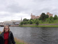
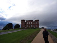
We finished our evening walking up the hill to the town castle, which is imposing and functions as a town hall and court. The inside of the castle is mostly just offices, but it has great views of the river. We wandered around for a few minutes, then found a pub at the bottom of the hill for supper, and called it a night. On to week two of the vacation!

Scotland 2017 – Day 7 – Saturday – Culloden battlefield and Inverness

Meredith and I split our vacations up, each being in charge for half the time. This came about one vacation when Meredith took some helpful suggestion on my part amiss and shoved the guidebook at me with a disgruntled, “If you think it’s so easy, YOU be in charge.” And so it was. Today marked the beginning of my time, and I wanted to head up to the Inverness area, which would reset our northern-travels record set yesterday.

Inverness is the biggest city in the Highlands, with a population of about 45,000 people. It also happens to be just a few miles from the Culloden battlefield, where Bonnie Prince Charlie and his Jacobite army fought against a government-backed army. Spoiler: Charlie lost.

I have a folk song on a CD about Culloden, so I wanted to see it. All I knew was that a battle had happened there, and according to the song, the Scots fought bravely but were defeated by the English. It turns out to have been much more complicated than that, involving politics, religion, succession to the throne, international plots, Scottish home rule, and more. Easy.

Here is the history as best I know it from the amazing museum at the battlefield:
James II is a Catholic king in a Protestant England. The parliament suggests that he step down and let his Protestant daughter Mary and her husband William reign. James II does so and goes into exile in France and Rome. James II’s grandson, Charles, born in exile and thinking his father should be king, launches a plot with the French to invade England, since France is skirmishing with England all over the world and has won an important battle recently, leaving England in a bit of disarray. But bad weather over the winter scuttles the plans.

Charles then raises a private army and sails in two ships to Scotland. On the way, he meets an English ship, and in the ensuing battle, the English ship and one of Charles’s ships (with the most arms and men) have to sail back to their ports for repairs. Charles lands in Scotland with very little to help him other than charm and his own self-generated promise of French armed help. He still manages to raise an army of two thousand men and begins marching south, capturing Scottish cities along the way. He eventually gets an army of about ten thousand men, and they march south into England, against the advice of some of Charles’s generals. They get to about 120 miles from London, which throws London into a panic. The army then turns around and goes back to Scotland after hearing rumors of three separate armies advancing on them.

Back in Scotland, the big army breaks into multiple fighting groups as the Jacobites struggle to keep ports open to receive French aid. Charles and his army end up near Inverness. He knows the Prince of Cumberland’s army is eleven miles away, and is bigger and better equipped. So Charles orders a night march and attack, but the march is across country, in the dark and fog, and in the snow. The army gets about a mile from the government forces, and the commander of the attack (not Charles) orders them to withdraw since he thinks he has lost the element of surprise.

The army arrives back at Culloden after an all-night twenty-mile march. Some of the men go off in search of supplies. Meanwhile, the government forces march up. Charles and his leaders argue over where to fight, with some of his leaders wanting to move to better ground nearby. While they argue, the government forces line up on the best ground at Culloden. Charles makes the decision to fight there, which leaves the Scots lined up on some swampy ground. Since the best weapon the Scots have is “the Highland Charge,” in which the army runs at full speed into the other line and engages in hand-to-hand combat, the swampy ground is a major disadvantage. Also, over half his army is elsewhere, so Charles only has about 5,500 men to face 7,500 government forces. It does not go well. Charles loses, and about 1,500 Jacobites are killed to about 50 government forces. The government forces brutally kill the wounded and hunt down the Scottish Jacobites and either shoot them or deport them. The Irish and French soldiers who fought are taken prisoner and then sent back to France.

Scots fought on both sides of the battle, with somewhere between a fifth and a third of the government forces being Scots. It really was a civil war, and it was the last hand-to-hand battle fought in Britain (I’m guessing the Blitz counts as the last battle fought here).

The museum really is excellent. Down each exhibit hall are given the perspectives of the government forces on one side and the Jacobites on the other. There is a four-walled immersive film about the actual battle, demonstrations from actors, and a huge overhead bird’s-eye view of the battle showing how the lines moved. We even got to handle a period musket (they are heavy). We got a thirty-minute guided tour of the field, and then Meredith and I walked around it on our own. There are plaques explaining things, and there are lines of flags set up showing where the initial lines were. In all, it was really well laid out, and we spent almost five hours there.

We drove the short distance into Inverness, where we checked into our B and B, and then walked downtown to get supper. It turns out that restaurants are really busy here on Saturdays, even as early as 6:00 pm (Europeans usually eat later than we do). We finally found a place that would take us with only a fifteen-minute wait. It was an Italian restaurant run by actual Italians, and it was very good.

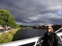
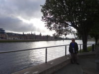
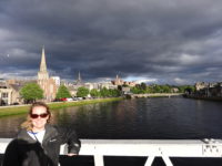
We ended the evening with a short walk down by the River Ness (which flows from Loch Ness). It was windy, but dry, with really cool light playing around downtown as the clouds shifted. I called it a fairly early evening, getting back to the room about 9:00 pm, with plans to sleep in tomorrow. Uneasy is the head that wears a crown, but at least the head can be well rested.

Scotland 2017 – Day 6 – Friday – Pitlochry, Newtonmore, Craigellachie, Ballater

People in Chicago, Ohio, and Maine like to tell you, “If you don’t like the weather, wait a minute.” That is usually exaggerated at least a bit, but I think the phrase must have originated in Scotland. We drove around in the highlands a lot today, but we were never more than one hundred miles from where we started. We started out in cloudy and calm, then drove into misting rain, then into rain and wind, then just wind, then mist again, then thick fog, and then into sun and clouds, all within eight hours and one hundred miles. When in Scotland, wear layers.

We started the day heading back to Newtonmore, back to the Highland Folk Museum. Meredith does not like to leave museums unseen, and we were passing right by it. She said she did not want to stay long. After an hour and a half, we had seen the rest of the museum. Yesterday we had seen the 1700s section, so today we toured the 1930s and 1940s section, which included a weaver’s, a tailor’s, a couple of houses, a meeting house/locker room for the Scottish sport shinty (like Irish hurling – a rough version of field hockey), a railway depot, a clock repair shop, a sheep farmer’s hut, and a farm. One of the most interesting exhibits was from the 1940s farm, which was set up for wartime Scotland. It included a table set with one week’s worth of food under rationing – it was not a lot. I had not remembered that rationing continued in Britain until 1954. There were some stories posted of children never seeing a banana until they were seven years old.

We got back on the highway, heading northeast, which kept adding to the furthest north we have ever been. We drove over to Speyside Cooperage, which is a barrel maker in the heart of whiskey-making country. Meredith felt we should do something related to whiskey, but neither of us drinks, so she decided to go to a cooperage instead.

It turns out that if you add swelling music, high-definition video, AND multi-sensory stimulation (like smells and heat lamps), you can make cask-making about as epic as Lord of the Rings. The introductory film was excellent. I did not know that whiskey gets almost all of its flavor and color from the cask in which it is aged. So the cooper insisted they are one of the most important parts of the whiskey-making process.

Speyside mostly repairs barrels; they only make about two hundred new casks each year, as opposed to about ten thousand repaired casks. A whiskey barrel has a lifetime of about sixty years, so it can be used three times or so for whiskey. Fun fact: bourbon can ONLY be made in new barrels, so many whiskey casks come from bourbon makers.

The coopers do most of their work by hand, and they are paid by the barrel. To become a journeyman cooper, you need to spend four years as an apprentice first. To repair a barrel, the cooper takes it apart and replaces any bad slats or iron bands. The cask will then be pressure tested and, if passed, it goes on. The inside charring (charring the inside makes charcoal, which helps remove impurities from the aging whiskey) is removed, and the inside is burned again to make new charcoal. The barrel is then ready for shipping. Oh, and the cooper shop had a calico cat wandering about on the factory floor. Good cooper kitty!

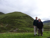
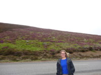
We turned back south, taking the eastern road through the Cairngorms National Park, which is supposed to be a very scenic drive. It was, but it started in the rain and, later, fog, which obscured many of the mountains. The hills were patchwork with green grass and brown heather, and it was a sobering landscape (except for the whiskey drinkers). As we got more and more south, we drove out of the weather and finally got some dramatic landscapes, especially as we approached the town of Ballater.

Ballater is a cute town, and has a pretty river running through it. The main claim to fame for the town is that Balmoral Castle, which is owned by the Queen, is nearby. I can understand why – the area is very beautiful, and Queen Victoria had a railway line built to the town for easy access to the castle. We wandered through the town for about half an hour, and then took the very scenic drive back to Pitlochry.

Pitlochry is home to an excellent theater festival, so Meredith had me swing by it to see what was playing. She picked up two front-row tickets to see Absurd Person Singular, so we stayed and ate a light supper at the theater, then saw the show. It was a dark comedy about three married couples each hosting Christmas Eve parties on three successive years. Underlying the plot was the drive for each couple to impress “the right people” at the party. It was very funny in many parts, and uncomfortable in others (the men of the play are pretty ghastly). It was a good play, and we had a great time talking to the retired Scottish couple from Glasgow who were sitting next to us. The husband was an avid cyclist who biked about seven hundred miles in a week last year on the continent, and he was a retired physicist who worked in medical imaging. The wife was a semi-retired ballet teacher and an avid theatergoer. They were interesting people to talk to.

Meredith milked all the time out of “her” last day before I take over tomorrow – we got back to the room at almost 11:00 pm after a full day of touring. I expect some of “my” days will involve sleeping in.